
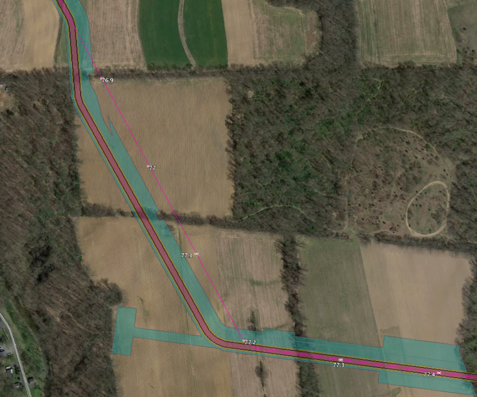
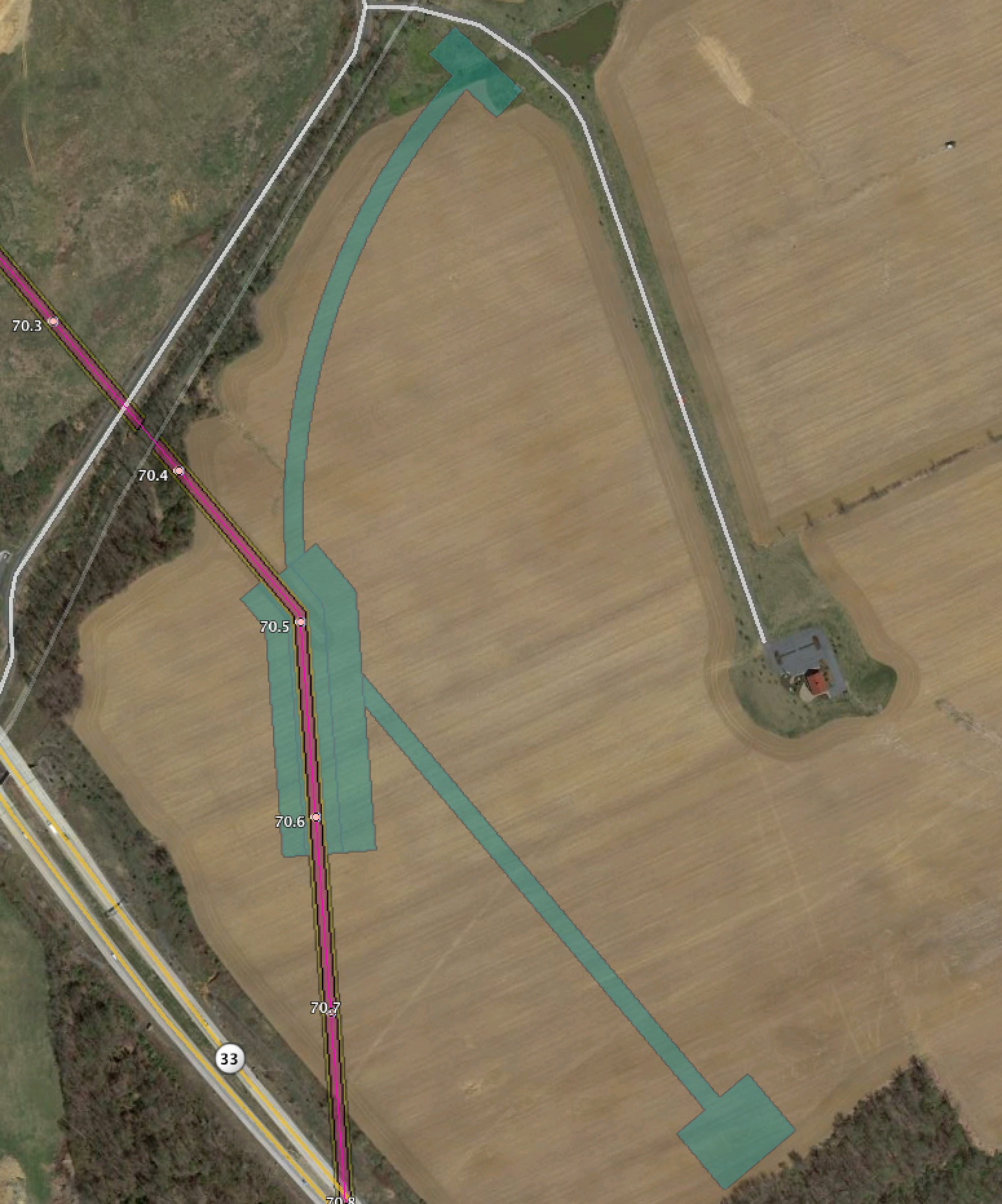
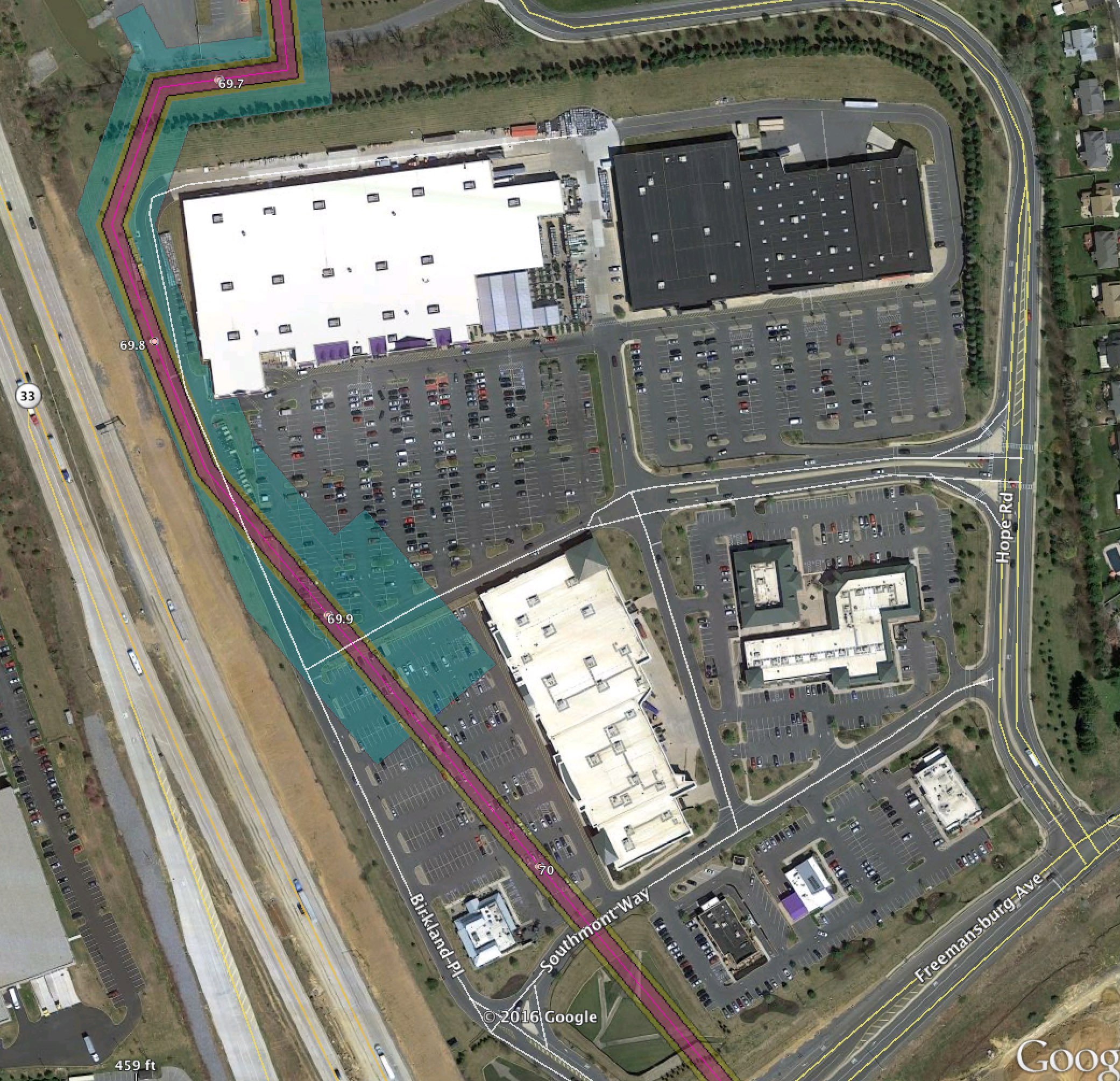
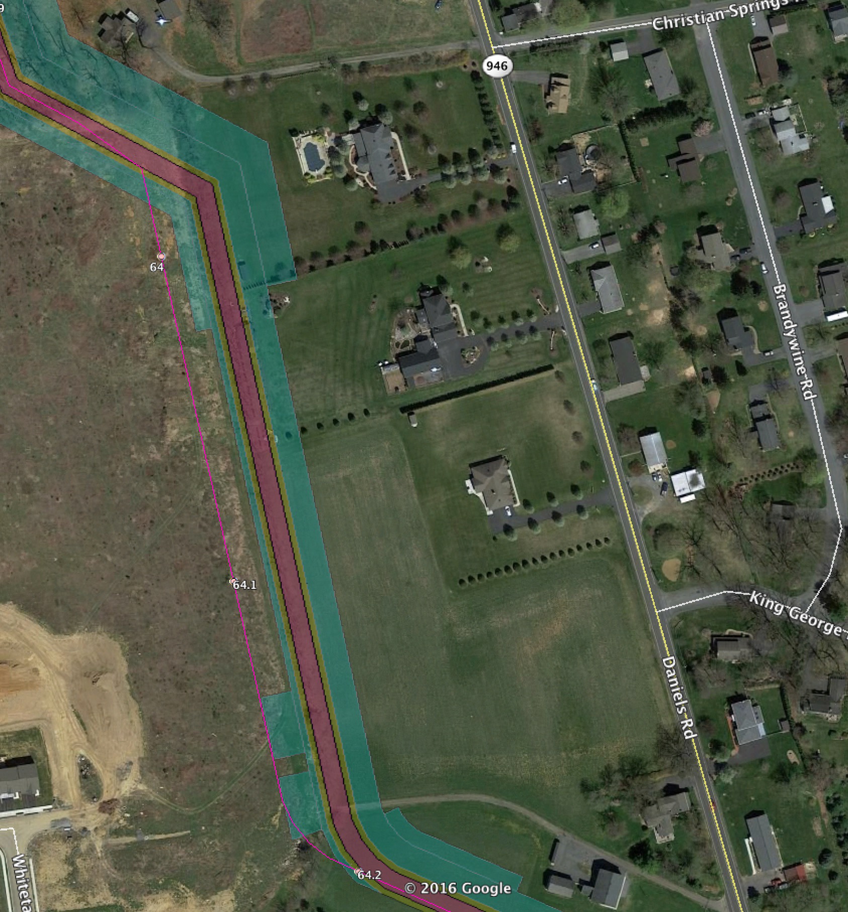
This post shows the differences between the February 2016 route and the September 2016 route, and also the new HDD site impacts from the September 2016 route.
This post covers PA. There was also one for NJ. I’ll also be covering access road impacts in a separate post as well.
In these posts the bright pink line with the milepost numbers is the February 2016 route. In some cases we include the 400′ survey corridor for that as well.
The new September 2016 route shows the actual ROW in faded pink and orange, and temporary work spaces in cyan.
PA Red Bridge Road
PA Hexenkopf Road
A large change near hexenkopf

PA Route 33 additional workspaces for HDD
More workspace for HDD south of the shopping center.
PA Route 33 Lowes Shopping Center HDD
The HDD entry/exit in the Lowes Shopping Center parking lot.
PA Daniels Road
Route moved closer to houses
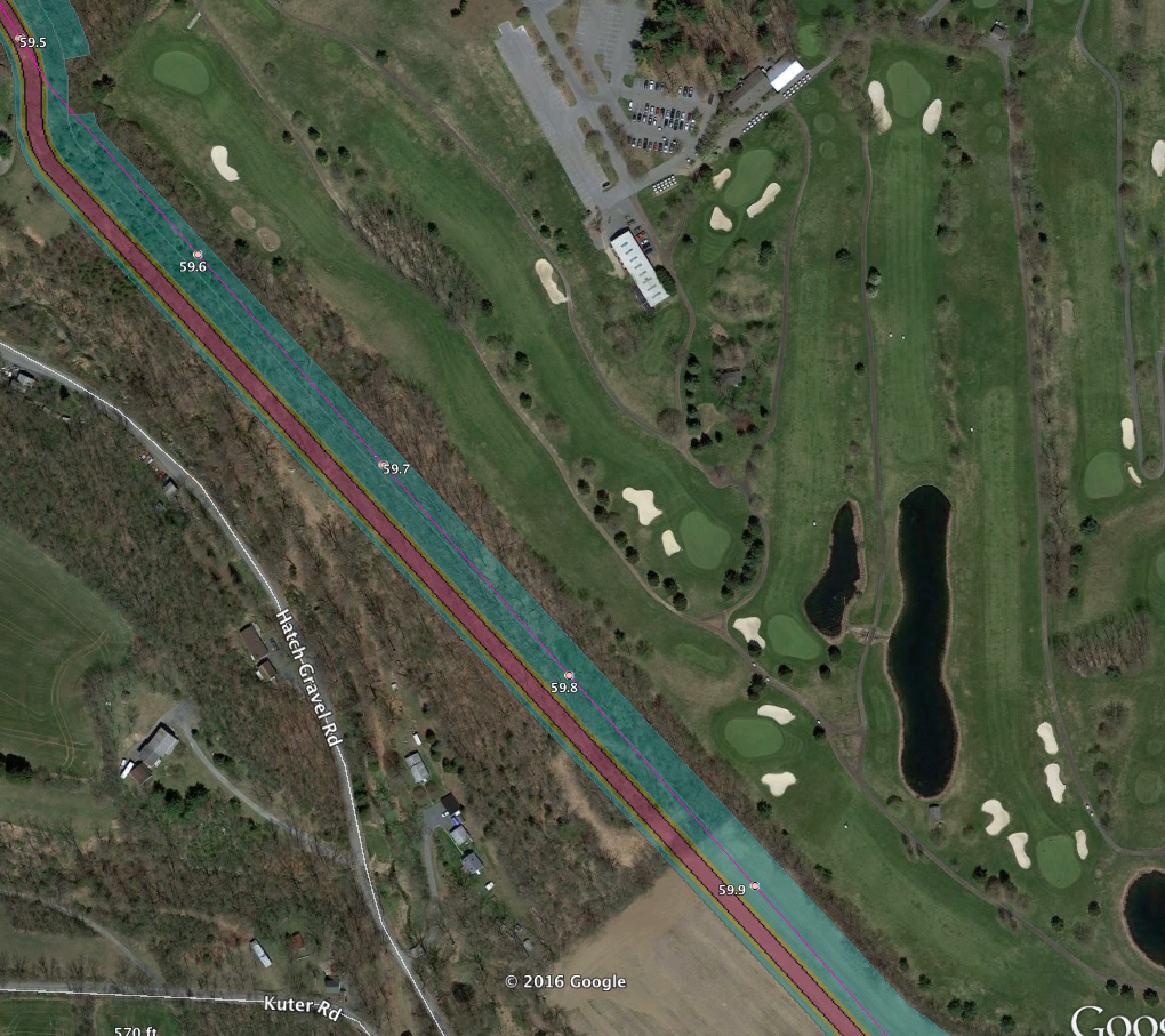
PA Move 50′ West of Golf course
PA Change across Dannersville Road

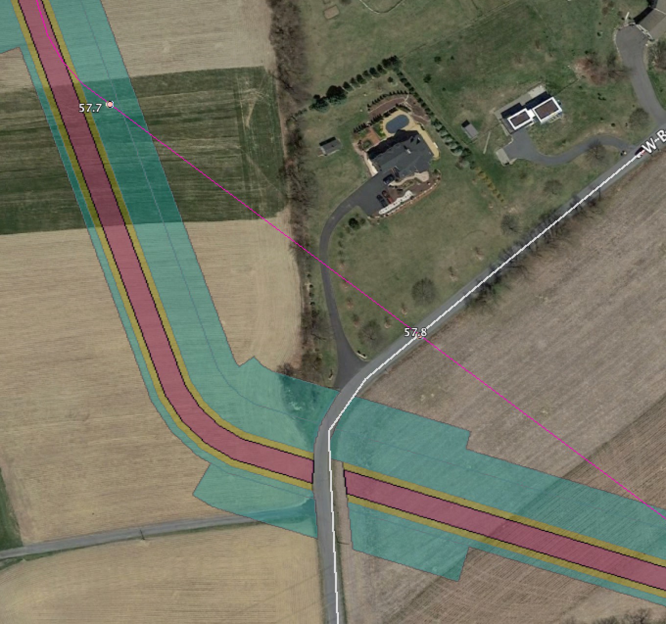
PA Change across West Beersville Road
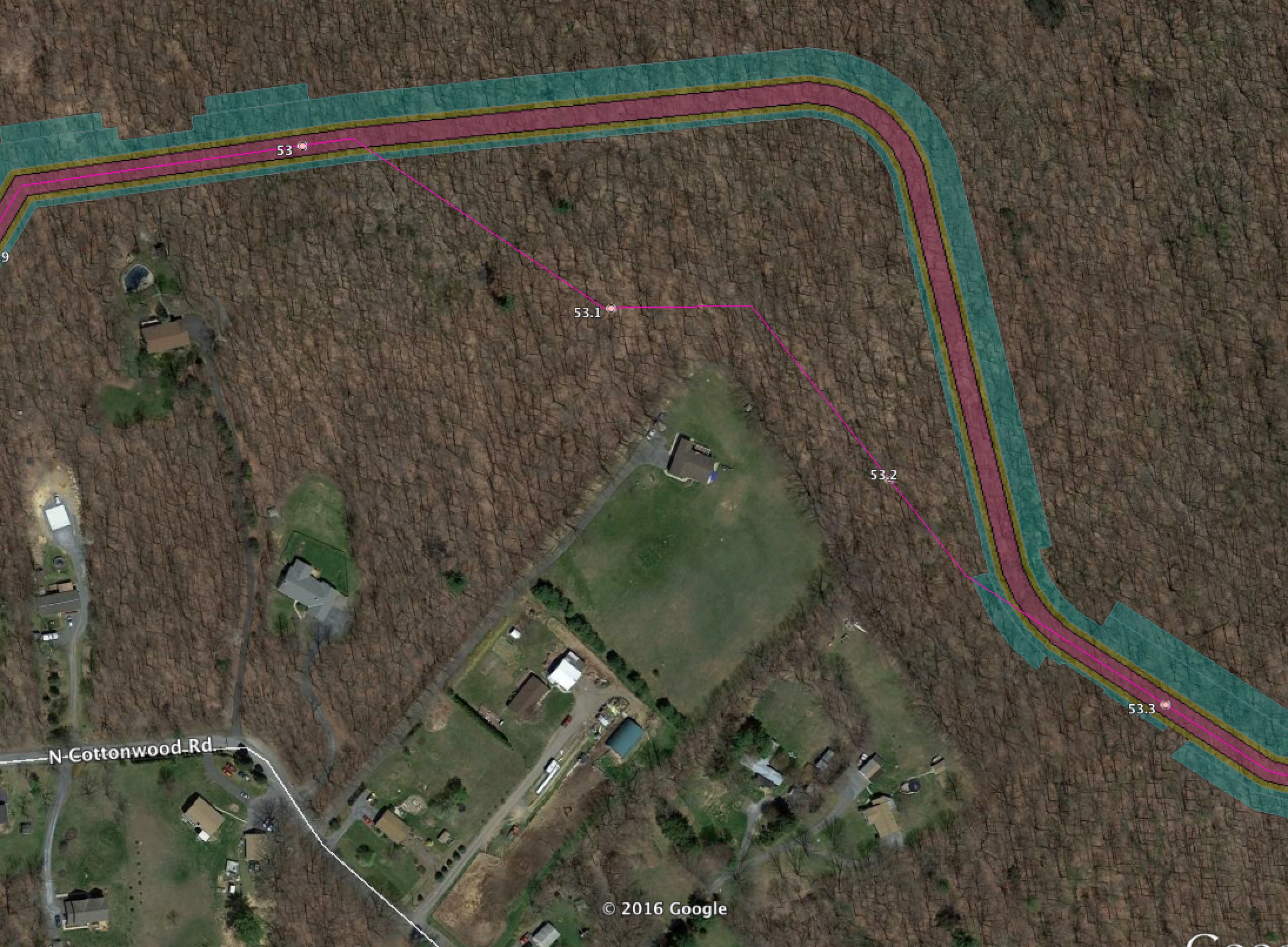
PA Change Cottonwood Road
Route expanded to cut more trees
PA Appalachian Trail HDD
A very large change by the Appalachian Trail. They are now doing a very small HDD under the trail itself, but with the corresponding large HDD site impacts at entry/exit. Plus far more extensive tree cutting to accommodate this route.

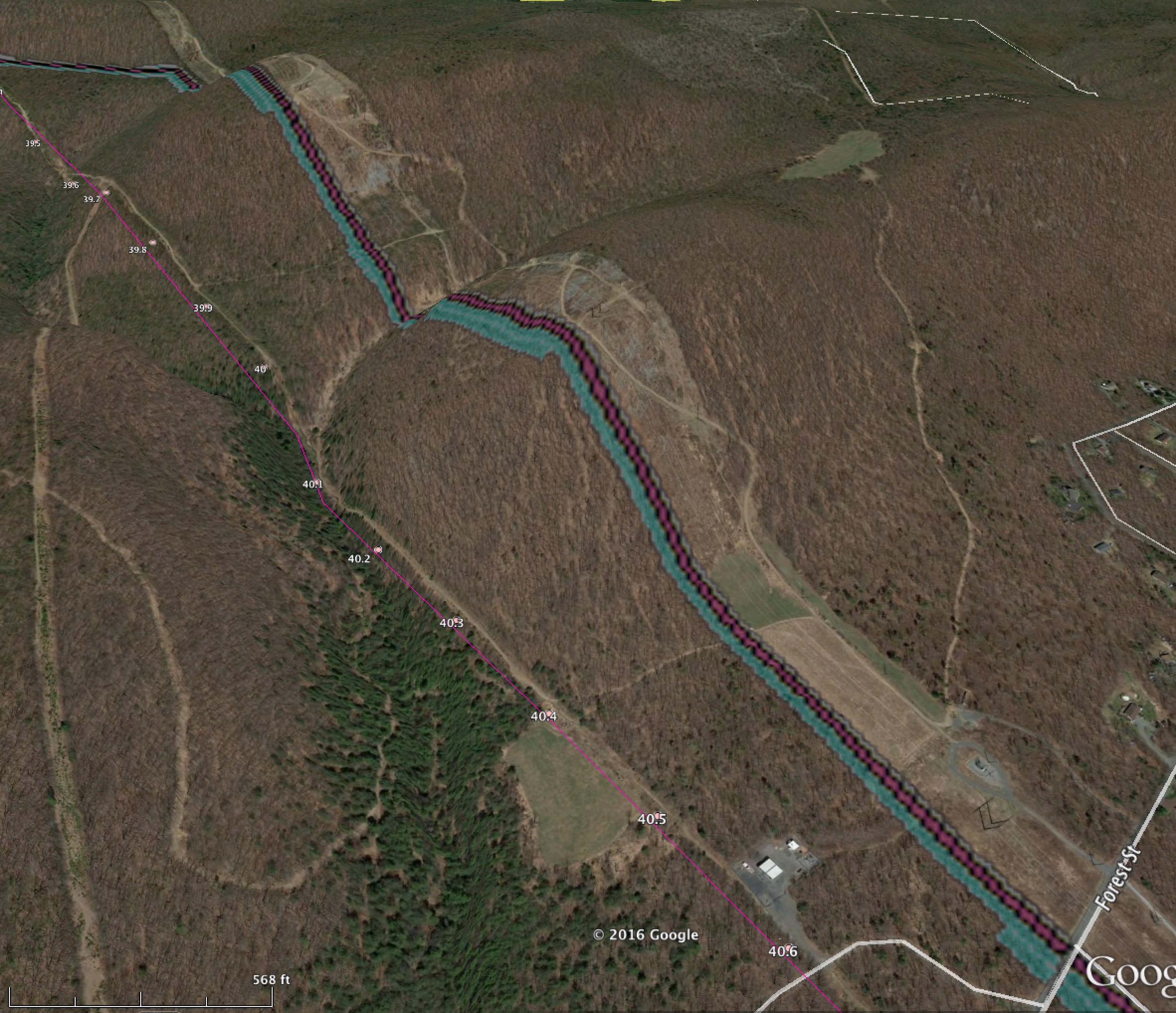
PA Blue Mountain “Easy out” area

PA Blue Mountain Trail Area change

PA Lower Smith Gap Road
A very large change moving the route over a thousand feet north on the other side of Lower Smith Gap Road.

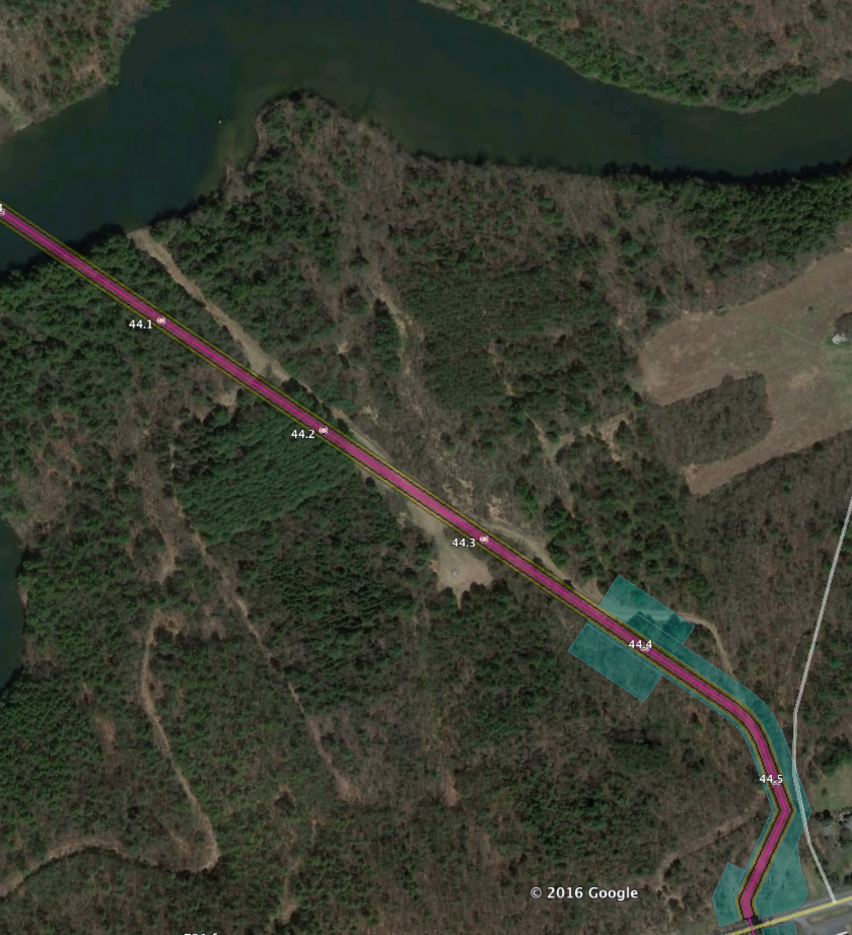
PA Beltzville Lake HDD Impact
PA Lovitt Road extensive new construction areas for HDD support

PA Hatchery Road Major Change
A major change near Hatchery Road to try to bring the pipeline within a utility easement. What it’s doing is actually widening an existing 200′ wide cut to 250′ wide. And now, instead of going through a valley, it is going up and down the mountains on steep slopes.
PA Kidder Compressor Site

PA Route 2020 Changes

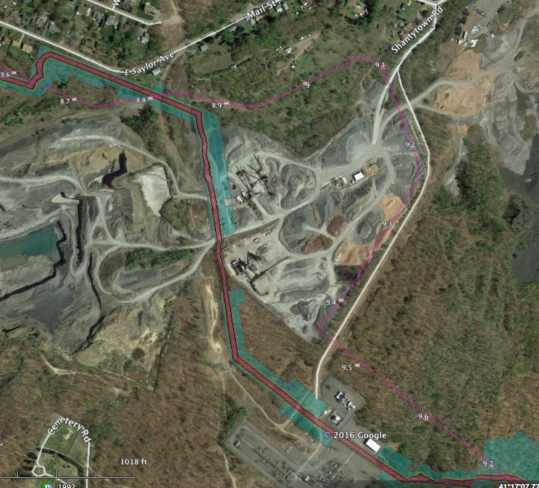
PA Shantyroad Road Quarry major changes
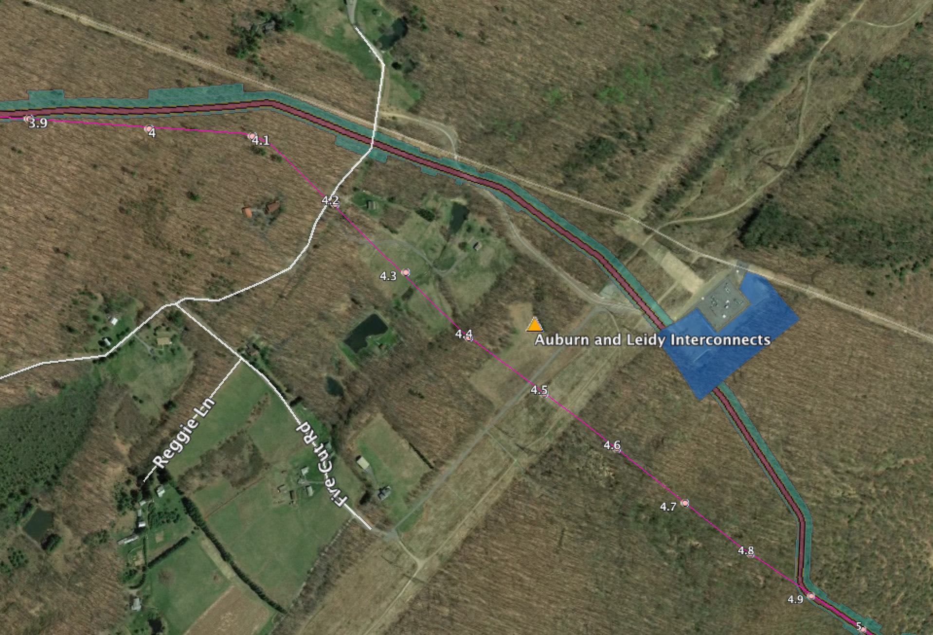
PA Auburn and Leidy Interconnects
Change for the interconnects into the UGI Auburn gathering system and the Transco Leidy line. The Leidy line is the one PennEast says doesn’t exist!
Running these sites is getting expensive. If you want to help out with the hosting and other costs of running thecostofthepipeline.com along with pipeinfo.org, then please take a look at the donate page. Thanks!


Published by