Delaware Township takes PennEast to task

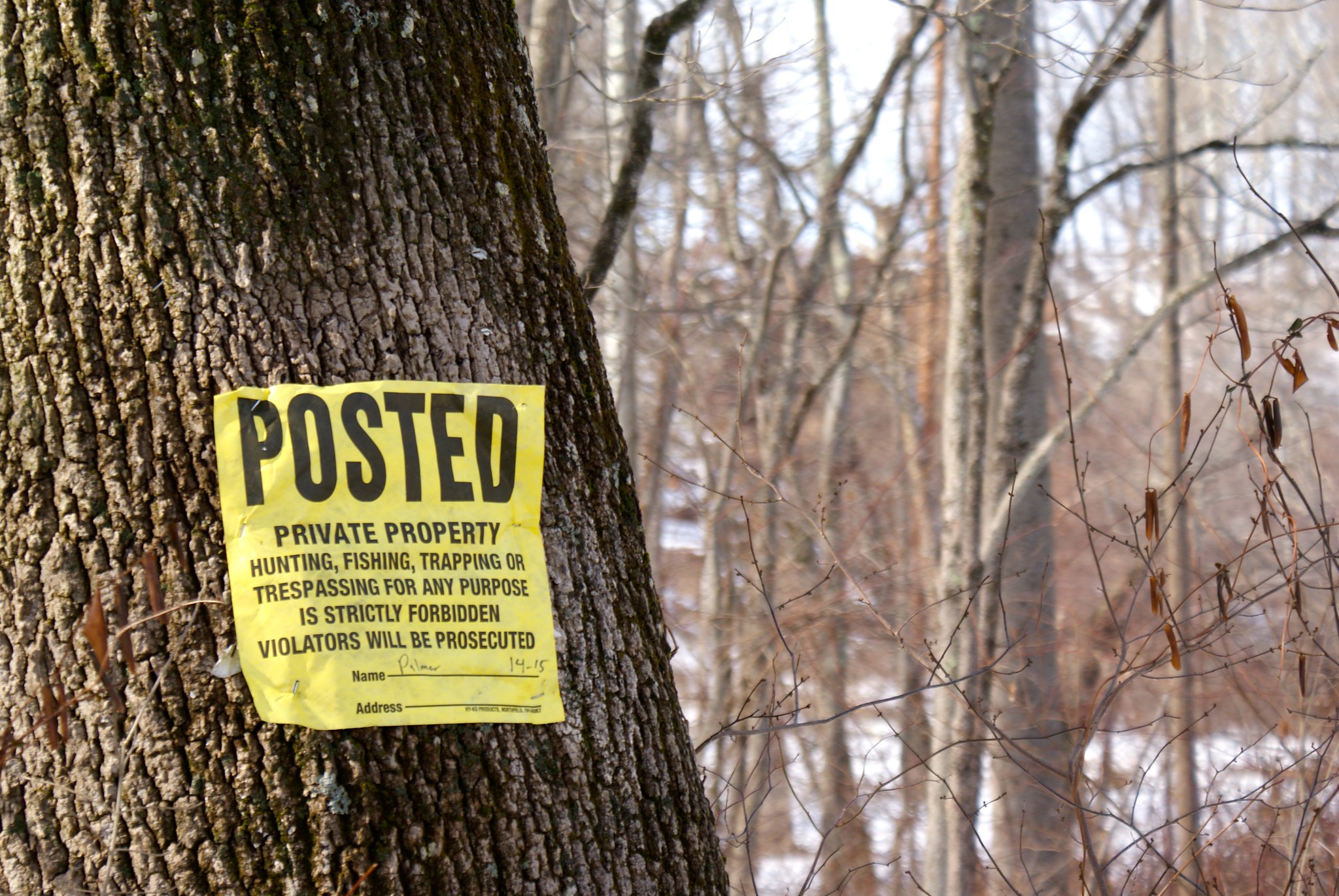
Delaware Township NJ filed a pair of FERC filings this week reprimanding PennEast for their ridiculously sub-par job in responding to scoping comments. They specifically held their toes over the fire for a number of scoping comments PennEast either ignored, completely misunderstood, or mangled behind comprehension. In one letter the Township committee laments:

Delaware Township reviewed PennEast’s March 13, 2015 submission and found that the majority ofresponses by PenneEast were boilerplate/canned responses. In additions, several of the issues raised by Delaware Township were not even addressed by PennEast. Delaware Township spent considerable time and resources preparing these scoping comments so having PennEast ignore and not acknowledge Delaware Township’s concerns is extremely disingenuous and disheartening.

They then enumerated comments that were not addressed, including:

  • Cultural and historic items.  “PennEast failed to address/acknowledge that comments had been submitted regarding the presence ofhistoric structures or sites.”
  • Conserved land.  “[We] made detailed senarate submissions on February 24, 2015 regarding the lands in the township that were conserved with public finds. Yet, PennEast failed to document that Delaware Township had made any comments.”
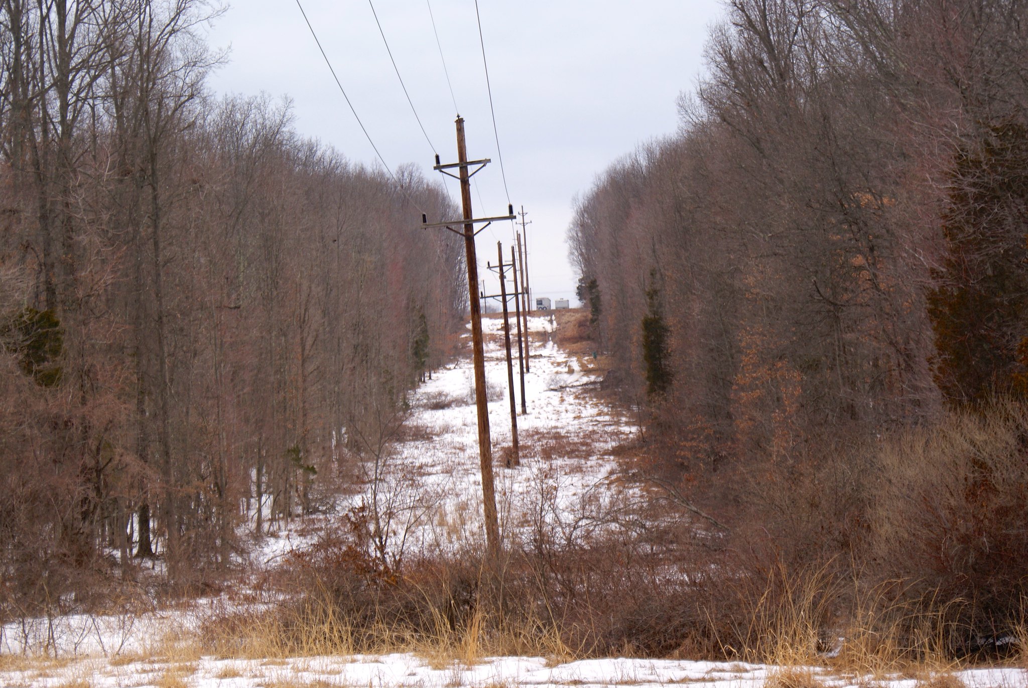
  • Abandoned Mines.  “PennEast apparently did not read the Delaware Township’s Quarry Compliance’s submission dated February 23, 2015. In this submission, the Delaware Township Quarry Compliance Committee provided information about an active quarry located in close proximity to both proposed routes of the pipeline. “Active” means that the operations, which include blasting of the diabase rock, are ongoing and not “historic” or “abandoned”. The Delaware Township Quany Compliance Committee had requested that PennEast be required to conduct an engineering/safety study on the effect on the blasting at this active quarry would have on the proposed pipelines. PennEast’s response failed to acknowledge this active quarry nor did PennEast propose to conduct an engineering/safety study on the effects of the blasting on the proposed pipeline.”
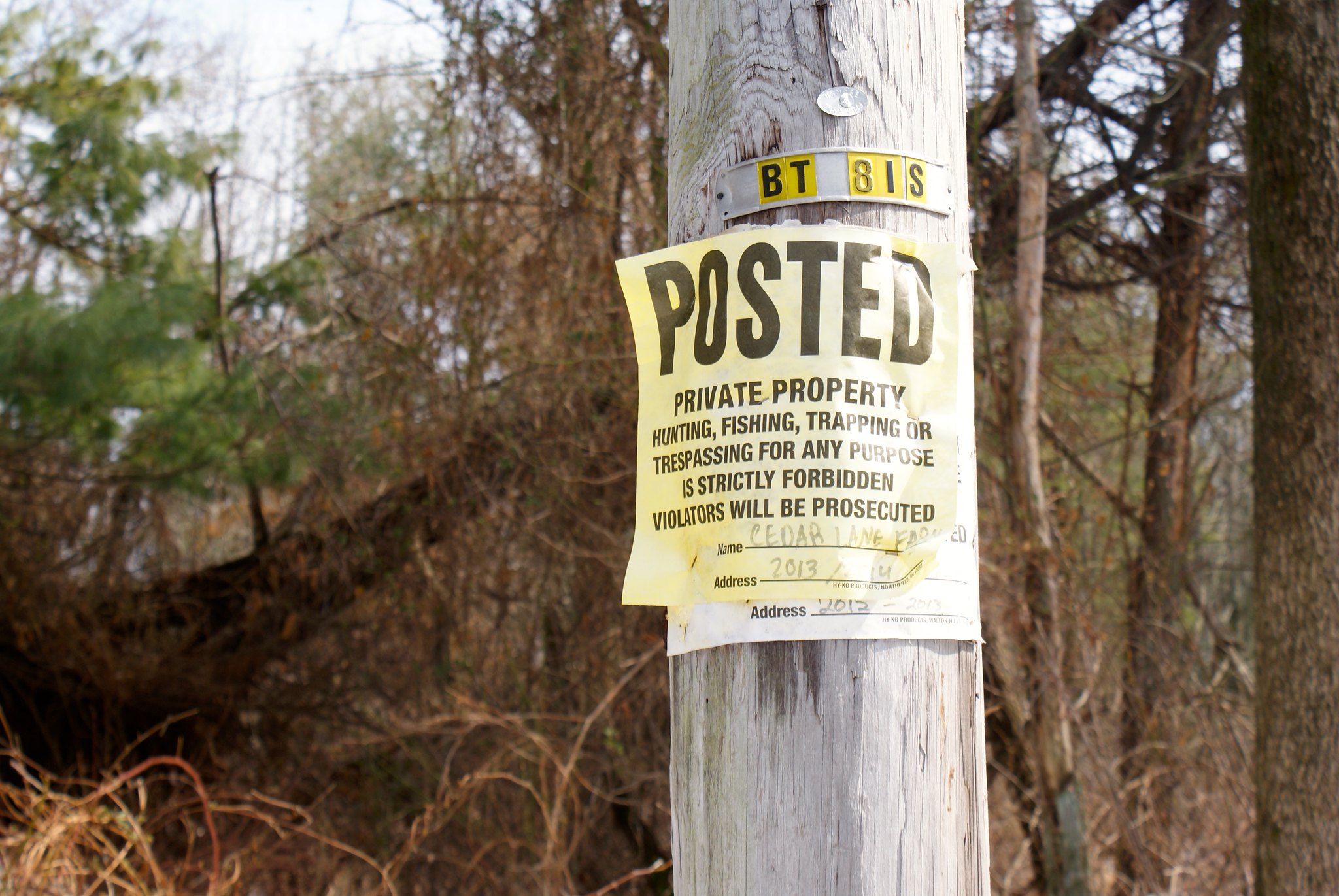
  • Eminent Domain.  PennEast failed to address/acknowledge that comments had been submitted by Delaware Township regarding eminent domain.
  • No Appendix A!  “And finally, on March 26, 2015 PennEast made a submission to FERC responding to scoping comments that were submitted between March 7, 2015 and March 20, 2015, including those raised at the five scoping meetings. In this submission, PennEast indicated that their responses are in Appendix A. However, there is no Appendix A that was posted on the FERC website. How can interested stakeholders review PennEeast’s submission when FERC has not posted the submission in its entirety?'”

In the second letter Delaware Township blasts PennEast for not only ignoring the Rosemont Rural Agricultural District but regularly getting its name wrong when it mentions it in passing. They begin:


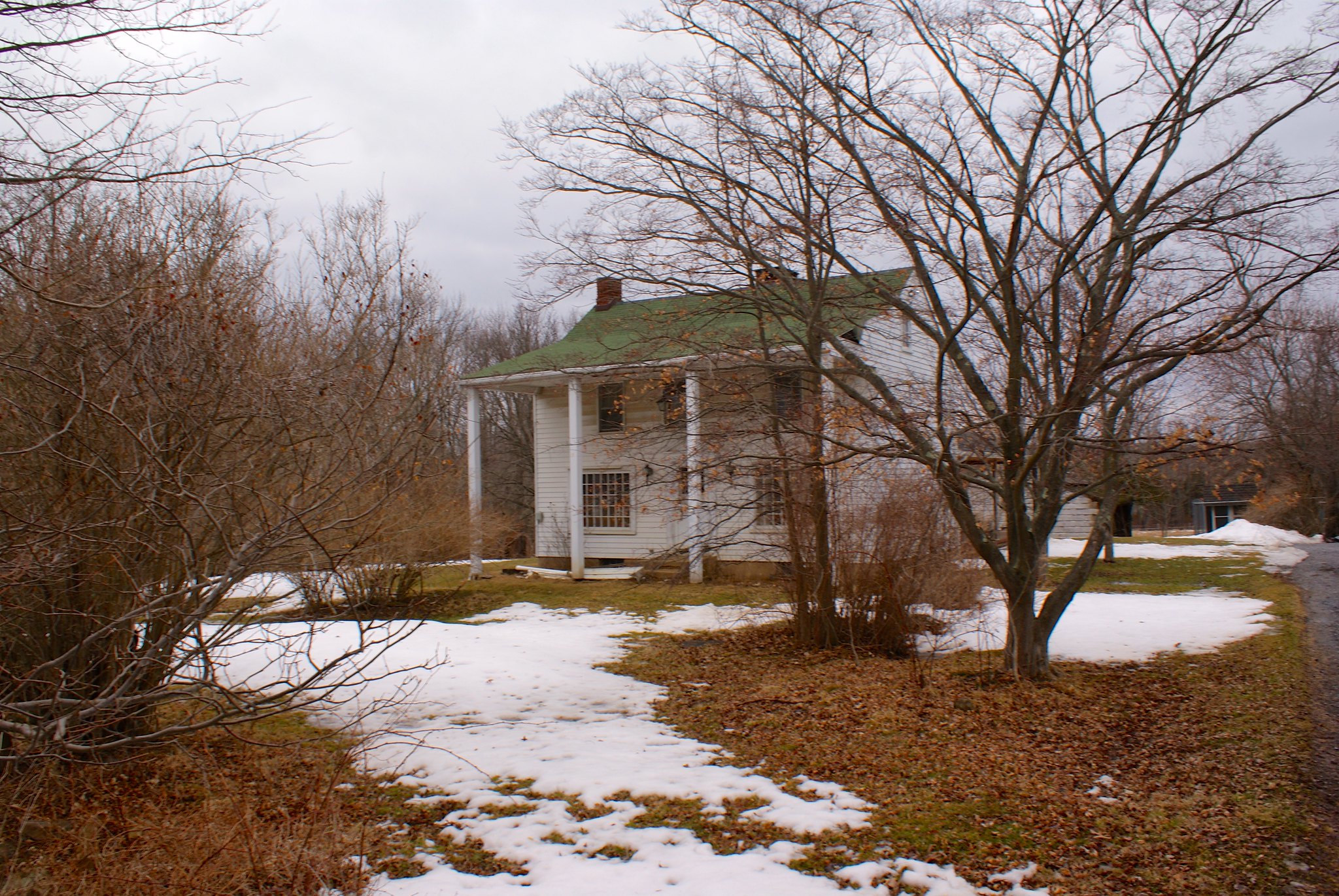
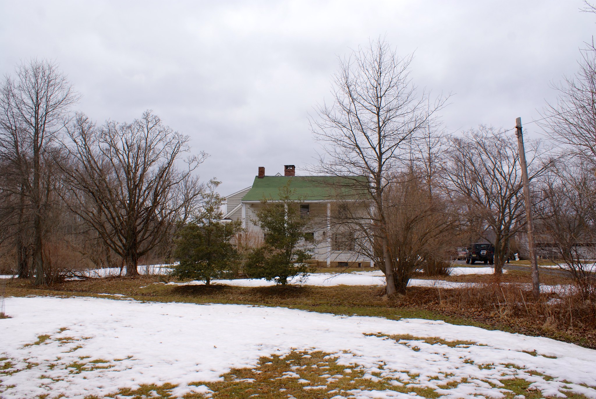
On December 9, 2014 the Delaware Township Committee sent a letter to the Federal Energy Regulatory Commission (FERC) regarding the township’s specific concerns about the proposed project’s intention to carve a footprint though the Rosemont Rural Agricultural District (ID¹4591).PennEast Pipeline LLC was copied on this letter.

In the December 9, 2014 letter, the township detailed how the Rosemont Rural Aericultural District (ID¹4591) was listed on both the New Jersey Register of Historic Places and entered into the National Park’s Service’s National Register of Historic Places.

The Delaware Township Committee sent additional detailed comments to FERC regarding the Rosemont Rural Agricultural District (ID¹4591)in a February 24, 2015 submission. Again, PennEast Pipeline LLC was copied on this submission.

Then the double barreled shotgun comes out:

But despite being provided with this information, PennEast continues to refer to this4
historic district as the “Rosemont Ridge Agricultural Development District” as referenced in PennEast’s March 13,2015 submission.

In addition, PennEast indicated in their February 9, 2015 and the March 6, 2015 Monthly Progress Reports that “Other concerns are being addressed through route alternatives or ongoing studies. For example the New Preferred Alternative route avoids areas of concern raised by the Historic District of Mt. Airy…..” And the Preferred Alternate route now avoids the Mt. Airy Historic District.

Delaware Township has raised concerns about the proposed pipeline carving a footprint through the Rosemont Rural Agricultural District (ID¹4591)yet it appears these concerns were/have not addressed by PennEast. Not only does the 10/7/14 original route carve a footprint through the Rosemont Rural Agricultural District (ID¹4591) but the 1/16/15 Preferred Alternate route continues to cut a footprint through the Rosemont Rural Agricultural District (ID¹4591).

Has PennEast not been reading the letters submitted by the Delaware Township Committee? Why has PennEast not addressed our concerns?

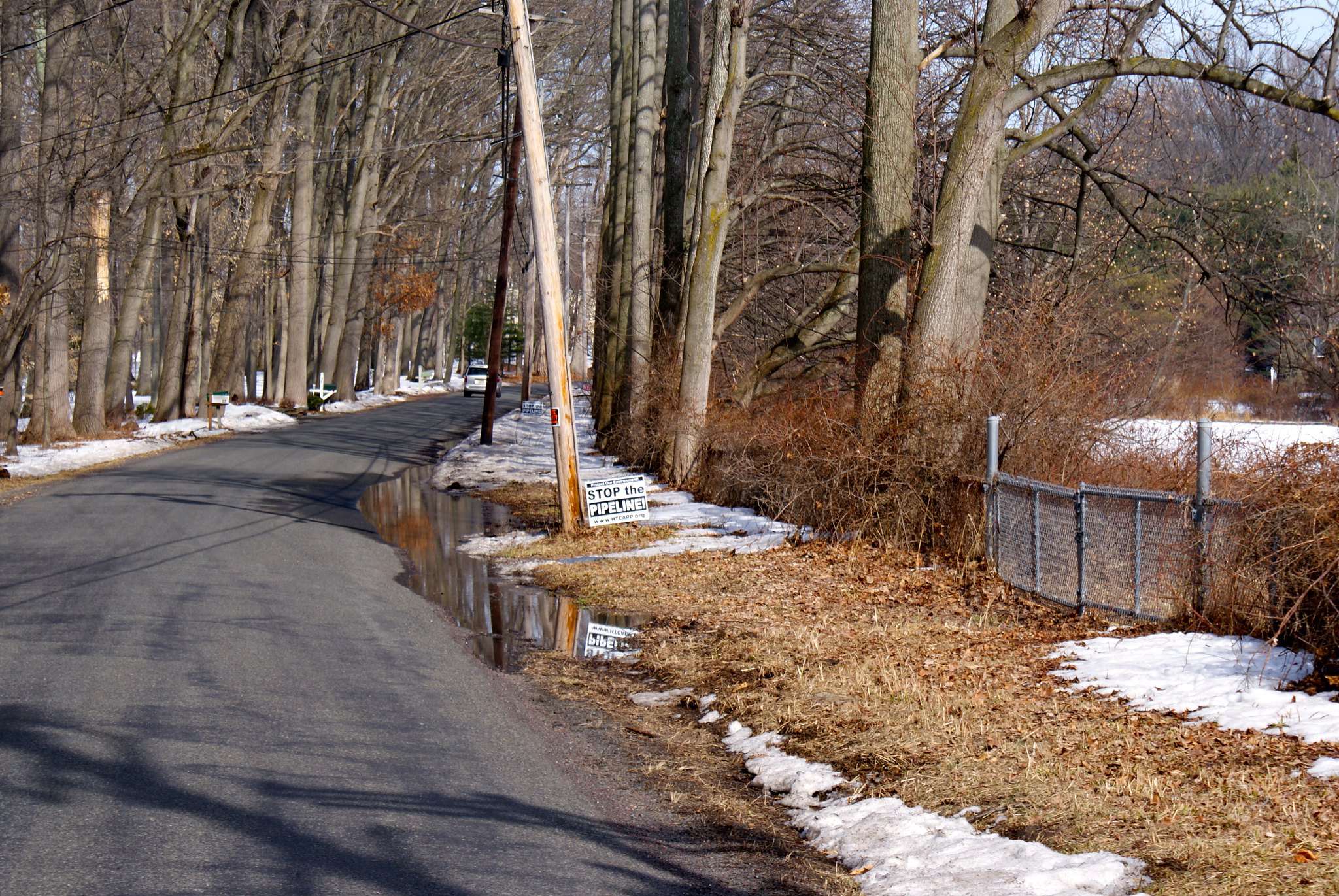
Delaware Township rightly points out that PennEast is messing up this process on multiple levels. They can’t even get simple things like official names and designations correct. Even worse, their responses are piecemeal. PennEast trumpets them “saving” the Mt. Airy Historic District in West Amwell, but at the same time they completely ignore the Rosemont Agricultural District in next door Delaware Township. It is infuriating to everyone involved that a company that commits so many gross errors is potentially being entrusted by the federal government to safely build a 3′ wide 100+ mile long high pressure natural gas pipeline through our communities.

The township closes by saying:

The Delaware Township Committee considers any siting of a pipeline through the Rosemont Rural Agricultural District (ID¹4591)to be an unacceptable and permanently intrusive, discordant, and disruptive influence on an area that has been recognized by state and federal historic authorities as an unique setting that serves as a window into our nations’ rural agricultural past.

The Delaware Township submissions are available below:

Delaware Township Submission 1
Delaware Township Submission 1 Alternate Site

Delaware Township Submission 2
Delaware Township Submission 2 Alternate Site

Photographing the pipeline route, Part 10: Revisiting Sanford Road

I received an email last night from Carla in Delaware Township.  She said that her farm was in one of the pictures I took on Sanford Road, and that there was a lot of interesting areas you couldn’t see from the road that would be impacted by the pipeline.  She offered me an invitation to come out and talk to her about her farm and the pipeline and take pictures along the way.

So my wife and I loaded up our two dogs (Fern, an American Fox hound, and Cinna, a pit bull mix) and drove on up.

When I met Carla she told me a little history of their farm. They bought the 137 acre property 16 years ago from a family who lived in Connecticut. Normally they would not be able to afford such a piece of land, but the Connecticut family worked with them and the purchase was part of a farm preservation agreement. This kept the farm permanently protected as farm land, and Carla and her husband got a farm with huge potential.

You can see their FERC submission below:

Carla and Dan’s FERC submission

Carla and Dan’s FERC submission Alternate Site

From her description the land was a bit of a mess when they got it. They’ve had to work hard to turn it into a productive farm that grows high quality hay. The same is true of the house, it was in pretty bad shape and they are still slowly renovating it into their dream home.

Their farm is long and somewhat narrow. Unfortunately the PennEast route goes right through the long part, running the entire length of the farm. It cuts right across their driveway, which will leave them unable to access their property during construction.

Carla graciously let me bring my camera and document some of the features on the property. It’s a good thing I brought my boots because the snow melt and rain has created acres and acres of mud on the property.

The Pond
A big feature of the farm and an area of deep concern related to the pipeline is a pond located on the farm. The pond is fed by Plum Brook, which is a tributary of the Wickecheoke Creek. The pipeline will be cutting across that waterway upstream from the pond, and any contamination from the construction will end up right in it.

Wider view of the pond
The pond is apparently man-made, it was created by a previous tenant by damning up the stream. A beaver apparently helped as well, it took down a lot of wood in the area to beef up the damning until someone shot it some time ago.

Closeup of the pond
The brook supports beavers, muskrats, and minks, and the pond contains many different critters including bass and many species of turtles.

Pond alternate view
PennEast of course says that their construction is no big deal and they will “mitigate” any damages. That is PennEast’s favorite word – they get the right to invoke eminent domain and pretty much put the pipeline wherever they please, and our sole consolation is they’ll “mitigate” any issues.

The problem of course is that PennEast will only focus on the area immediately in their construction zone. If material and sediment slips down stream they won’t even look for it. So any mitigation they might do would be to fix the brook – with probably nothing done at all for the pond if they inadvertently damage it’s environment.

Plum Brook
The brook is actually pretty substantial in size, doubly so during these times when there’s a lot of water. You can see from how steep the banks are that it must really flow strongly during heavy rains and has carved a deep niche for itself.

Walking along the brook
We walked along the brook to the west towards the power line easement and proposed route. Along the way we were chatting about rescue dogs and techniques to calm the most skittish ones over time. She’s got several cats and dogs in the house plus is holding a new rescue. They’re mostly smaller breed dogs, she can’t get breeds that need to run a lot outside. The problem there is the ducks and chickens on the property. One week and bigger dogs like ours would make the fowl their dinner.

At the easement
We arrived at the easement and I had a much better view of what it looked like away from the road. As you can see the power company has let it go semi-wild. When PennEast comes through this whole area is going to be stripped bare. And, as elsewhere, it looks like they’ll need to widen the cut.

The Kestrel Nesting Boxes
Our true reason for going to the easement area was that Carla wanted to show me the Kestrel Nesting Boxes. Apparently there is a state program that is run to help preserve Kestrels. They help make these nesting boxes, and they also band birds in the wild for tracking. You can read more about the state’s kestrel program in the area here. As you can see in the document the kestrel is a State Threatened species.

Here’s a kestrel box on a telephone pole right along the pipeline route. I wonder how PennEast is going to “mitigate” damage to these birds given their breeding and living grounds are right on top of the route.

Alternate view of kestrel box
Another view of the box. There are several of these strung along the route.

Krestrel Banding
Carla sent me some snaps of the Kestrel banding process.


A view up the cut
This shot is a closeup of the route going north up to Hewitt Road. You can make out the trailers parked at the top which are in my previous Hewitt Road shots.

You can also see the steep slope it goes up, and which PennEast will be widening. The runoff from the extended cut will be going right down into Carla’s farmland.

The house
A view of their house. The pipeline will be running just a couple of hundred feet, well within the zone where spontaneous ignition of flammables will occur if there is a pipeline accident.

Driveway view
A view from their driveway. You can see the pipeline route cutting right across it, cutting off access to their property during construction.

Final house view
A final view of the house. You can see my wife’s Jeep in the driveway on the right. It looks like some old growth trees may be in jeopardy if they build through here as well.

My two helpers
I’ll close with shots of two of my helpers, Fern and Cinna. Fern is 100% American Foxhound on one side, and it really showed today. The farm had droppings from several different critters – we saw deer and fox, and the fox had her heart racing. It was an effort to keep her under control in the slippery conditions, but we managed. Carla helped out when I was taking pictures, for which we are very grateful.

The purpose of highlighting properties like this is not to make a NIMBY case against the pipeline. Rather, I think this shows how little planning pipeline companies put into laying out these routes. It would be hysterically funny to highlight all of the bad routing decisions made along this path – if it didn’t impact so many lives so severely.

PennEast has shown their incompetence in planning out a pipeline route. Do you have any confidence at all that their skill at actually building it will be any better?

Fern hound says good evening, with a smile.

China says the same.

Photographing the pipeline route, Part 7: More of Delaware Township

More in Delaware Township NJ.
Worman Road
A protest sign along the route at Worman Road.

Worman Road head-on view
A head on view down the pipeline route looking south.

Worman Road to the north
A view of the route to the north. Note the really cool carriage warning sign below the speed limit sign. There are lots of those signs around this area and really shows the ultra-rural character of the region.

Covered Bridge Road Scenic View
A scenic wide-angle view of the country the pipeline will be going through.

Lower Creek Road Red Bridge Farm
Lower Creek Road is a really cool road. The Wickecheoke Creek runs along side it for a great distance, and it was rough and wild after all the snow melt. This shot is the entrance to the Red Bridge Farm, which appears to have been in operation for over 300 years. The pipeline is cutting the length of their property and also going across the creek.

Lower Creek Road view north
There was a big pause in time between the previous shot and this one. First a car was blocking the road for awhile, someone was parked talking to a resident who was on foot. As they went by I saw it was a protest car – the whole vehicle was covered in anti-fracking stickers! I guess they were interviewing people along the route. I then had to turn around, so I turned around in the gentlemen’s driveway. And promptly backed into his mailbox. Twice. Mortified I jumped out and apologized and offered to pay of for it. He refused after several tries but we got to talking a little. He immediately wanted to know if I was pro pipeline or con. He seemed very relieved when I said “con”, and he said I was free to take as many pictures of the land as I wanted, and very pointedly said he wouldn’t let any pipeline people on his land. He went back to clearing out his drainage ditch and I got back to taking pictures.

Lower creek road view south across Red Bridge Farm
Here you can see the iconic red bridge of the Red Bridge Farm. And the pipeline route crossing the creek, cutting off their driveway, and then mounting up a very steep ridge.

Lower Creek Road, another view north
Yet another protest sign along the route.

Lower Creek Road, closeup of Red Bridge
A close up of the red bridge and steep ridge with the creek below.

Lower Creek Road north alternate view
An alternate angle looking north.

Lower Creek Road Posted
Another Posted sign along the route.

Lower Creek Road Wickecheoke view
The wild and wooly Wickecheoke after snow melt run off. The Creek has a preserve dedicated to it.

Lower Creek Road Wickecheoke protest sign
Another protest sign along the creek. I wonder if this area is prone to flooding…

Photographing the pipeline route, Part 6: Delaware Township

Part six takes me into territory I’m less familiar with.  Mostly I only know route 29, and the route 179/202/31 corridors.  All the land in between I’ve only explored minutely.  If I get any names or details wrong please let me know. Also the boundaries between Ringoes and Delaware Township is a bit fuzzy to me and there’s lots of little neighborhoods mixed in for good measure.
Lambertville Headquarters Road
Around Alexauken Creek the power line easement converts from high tension power lines to regular power lines. In many cases the cut looks much smaller as a result, which means PennEast will have to again widen cuts to make room for construction.

Lambertville Headquarters Road second shot
An alternate view of the route. As you can see the cut is fairly narrow here.

Cedar Lane Farm Posted sign
A Posted sign from Cedar Lane Farm adjacent to route.

Brookville Hollow Road sculpture
On Brockville Hollow Road I came across the “Turtlemoon Studio” which appears to be adjacent to the pipeline route. They have this simply awesome eagle sculpture at the base of their driveway. Anyone know anything more about them?

Brookville Hollow Road Looking South
A view of the pipeline route looking south from the road. Another steep slope, and you can see the cut is not sharp like in many places but somewhat over grown and still very narrow.

Brookville Hollow Road Looking South Alternate Angle
An alternate angle of previous shot.

Brookville Hollow Road Looking North
This is the view looking north along the route from the road. There is a beautiful fenced in property here with gorgeous landscaping. The pipeline route appears like it will cut right across their driveway. There’s a small stream right behind this house that the pipeline will also go across.

Sandy Bridge Road Looking south
A relatively flat and open section of the route, with the pipeline going through an open field.

Sandy Bridge Road Alternate Shot
Alternate shot of Sandy Bridge Road.

Sandy Bridge Road Anti pipeline sign
A protest sign next to the route.

Sandy Bride Road Looking North
A shot looking north. You can see how little the cut is here too.

Sandy Bridge Road wider shot
A wider shot of the previous one.

Easement realities

Richard, Anthony, and Beverly of Delaware Township have a conservation easement on their farm, a very common thing in Hunterdon County. I like to read our town Open Spaces Committee minutes (they’re available online!) to see how the conservation process works, and to see what properties are being considered in my town.

One aspect of the process I forgot about is that you owners can ask for exception areas. These are exceptions to the conservation easements so the families can have some limited development rights. They’re usually very well defined and for a very specific reason.

This trio points out how these exceptions can make a bad situation even worse when the Pipeline company comes knocking on your door.

Four generations of the Danese family have worked the land for nearly a hundred years in Delaware Township, New jersey. Our 67-acre farm (Block 32, Lots 32 & 32.01,Delaware Township) has served as the center of our family’s history, life, and livelihood in this portion of Hunterdon County.

In recognition of the very special place that our farm occupies in our family’s heart, we agreed to preserve our farm in 2009, and accept the restrictions that farmland preservation places on landowners. Our farm was preserved with State, County, Municipal, and Federal funding through the Federal Farm and Ranch Lands Protection Program. We thought that we had preserved our land in perpetuity and that one of the parties to that agreement was the government of the United States of America.

Now we have been contacted by the PennEast Pipeline Company LLC, who tells us that they wish to run a high pressure, 36-inch gas pipeline across our preserved farm. What is worse, we fear that this pipeline will bisect a small area that we had exempted from the preservation as a non-severable exception area, to serve as a building envelope in the event that any of the future generations of our family wished to establish a home on that site. A high-pressure gas pipeline running through the non-severable exception area would make our building envelope useless as an area to build a home, and would destroy the remaining value of our preserved
property.

The Danese family has proved our willingness to abide by the restrictions imposed on our property by the preservation easement in order to preserve our farm for future generations. We are both shocked and saddened that the Federal government, our partner in land preservation, would even think of allowing a high pressure gas pipeline to cross our Federally preserved property and abrogate the agreement that we thought would be in effect in perpetuity.

Their filing is available below:

Richard, Anthony, and Beverly’s filing – FERC Generated PDF

Richard, Anthony, and Beverly’s filing – FERC Generated PDF Alternate Site

Flammable gas pipelines and quarries – a match made in heaven, am I right?

Stephen from Stockton NJ tells us about the Trap-Rock quarry in Delaware Township. The pipeline will be running within a few thousand feet of it…where they routinely use blasting. And where, as many have pointed out, the ground is predominantly diabase, a very hard rock that transmits vibrations (e.g. like those from blasting) surprisingly long distances.

I am opposed to the obviously short-sighted reliance and expansion of our dependence on the climate-changing fossil fuels transported by the proposed Penn-East pipeline (PF-15.1). The safety issue raised by putting this pipeline so close to the active Trap-Rock quarry in Delaware Township NJ must be seriously addressed before the committee can consider accepting the plan. Both the original route and the newly presented alternate route come within a few thousand feet of the quarry, where blasting of the bedrock occurs. The blasts create seismic vibrations along the diabase bedrock that extends well into the proposed pipeline routes near the quarry. the harder the bedrock, the greater the transport of the seismic energy.

Surprisingly, the alternate route remains closer to the blast site for an even longer distance than the original route. Both routes are unacceptable, as is the whole short-sighted pipeline concept. Peak particle velocities (PPV) are high enough that residences along this bedrock within a few thousand feet from the quarry blast sites are significantly shaken by the blasts. The proposed pipeline routes are at a similarly close distance to the quarry and on the same bedrock formation.

Within a few years, these seismic vibrations will create local stresses and strains on the pipeline and welds, allowing for formation of defects that will enhance subsequent corrosion. Obviously, this will significantly increase the probability of cataclysmic rupture of the pipeline.

The developers of this project ignore this problem but realize that the probability of pipeline failure is significant enough to become an LLC so as to protect themselves. Who will protect the other Americans along these routes, or are some just ‘collateral damage’? Co-locating the pipeline near blast sites is a ridiculously short sighted endeavor. We have seen no indication of real-time surveillance of pipeline integrity during pipeline usage.

How has the committee assessed the problem of the co-location of the pipeline near a blast site? Are there specific seismic measurements along the route near the quarry? How does the planned expansion of the quarry fit into the future safety of the pipeline? Is there an assessment regarding multiple years of seismic activity caused by the blasts on the integrity of the pipes and welds? The land in the area of the pipeline near the quarry, between Brookville Hollow road and Lambertville-Headquarters road, is diabase and a poor drainage area. What is the effect of long term water exposure in the wet soil on pipeline and weld durability, especially after damage caused by the seismic quarry-initiated vibrations? What is the shut-off time if a rupture occurs? Will it be similar to 1.5 hours seen in the San Bruno explosion? Has the committee done its due diligence in protecting the public and ensuring the long-time viability of this precarious venture?

I know this quarry! You can see it on the D&R Canal tow path between Stockton and Lambertville, my wife and I take our dogs walking on their regularly.

Here it is on Google Earth in relation to the pipeline survey corridor:

As you can see Stephen is correct, the pipeline passes within 3,500 feet of the pipeline.

There’s another active quarry near me where the pipeline also will be passing – the one by Baldpate mountain:

This one is 3,100 feet from the pipeline route.

Why would you place a pipeline that close to blasting sites? And then double down by putting the pipeline into hard bedrock that’s going to transmit those blasts highly efficiently right to your pipeline welds?

Stephene’s submission is below:

Stephen from Stockton – original submitted text

Stephen from Stockton – original submitted text Alternate Site