
This is part 17 of the 3D flyover video series of the PennEast routes. In this installment, we look at the route in the area of Beltzville Lake between mileposts 49 and 40.
As always, the 400′ survey corridor is in smokey gray, the pipeline 50′ permanent easement line is in red, and the light blue areas are temporary construction zones. There is also a 100′ construction right of way not shown here.
I have also begun organizing these videos, they are all available under the “3D Flyover Videos” top navigation area.
Starting at 0:30 in the video and for a large portion of this part of the route, we see extensive traversals of the pipeline up and down steep slopes. Most of it not co-located at all. So we have a very unfortunate roller coaster ride through some of the prettiest wooded and agricultural land in PA.
At 2:40 we enter the Beltzville Lake area. PennEast is proposing another whopping 6,000′ long Horizontal Direction Drilling (HDD) attempt across both prongs of the lake formed by Wild Creek and Pohopoco Creek. This is a massive drinking water reservoir system as well as recreational lake. Here is a side view of the proposal there:
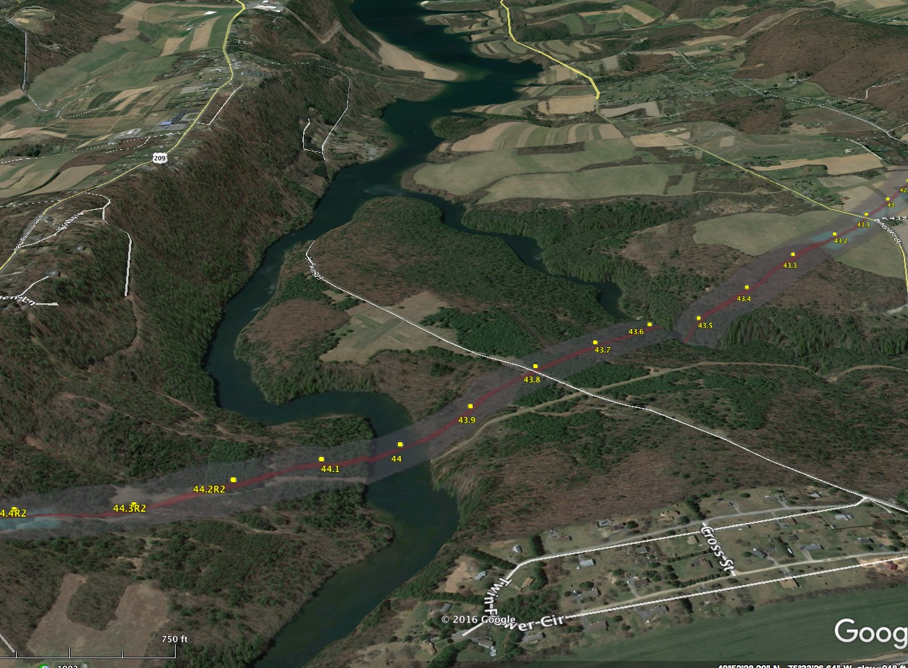
And here is the HDD plans top-view:

And the HDD plan vertical profile view (that shows how deep it goes).

The HDD looks great, so long as it works. As with the other sites in the area, if it does not work, PennEast will simply ask for a variance from PADEP to open-trench this area as well. Given the dearth of survey data it generally has available, nobody knows if the HDD is actually a viable option here or not.

Published by