
As many of you know, this week PennEast started filing condemnation cases against land owners who have refused to give PennEast survey access or sell them permanent easements.
I’ve put a list of parcels and landowners together, available at the links below. One is Excel, the other is in PDF format for those who don’t have Excel.
PEEminentDomainParcels (Excel Spreadsheet)
Please note this is NOT the final list, the courts have been slowly getting these filed. Here are some stats that should horrify nearly anyone who lives in this region, or who cares about property rights:
- So far there are 171 impacted property parcels
- Over 130 families and conservation agencies
- 160.104 acres will be permanently seized for PennEast
- 303.44 acres will be destroyed for construction purposes
- There are 115 parcels in NJ, and 56 parcels in PA impacted
Some notes on the Spreadsheet:
- Data was compiled from pacer.gov with some hand data-entry. So there may be some mistakes, gaps, or dupes
- Columns C-H are hidden, those are additional owners/lien owners being sued
- The block and lot info and a link to NJParcels.com is provided for NJ based on the tax parcel ID. I’m not sure how this translates for PA properties. NJParcels shows a map (usually) and address info on where the property is
- I haven’t listed mortgage information or power line easements
- Some of these properties with conservation easements may have signed agreement with PennEast, but were forced to go to eminent domain by agencies such as the NJ SADC.
- Some condemnation suits have multiple parcels, those have been split out into individual rows (so there are more parcels here than lawsuits in pacer.gov)
Debbie Kratzer has gone and above and beyond and took this raw data and turned it into a map to show where all the eminent domain hold outs – our heroes! – are located along the route. See below:
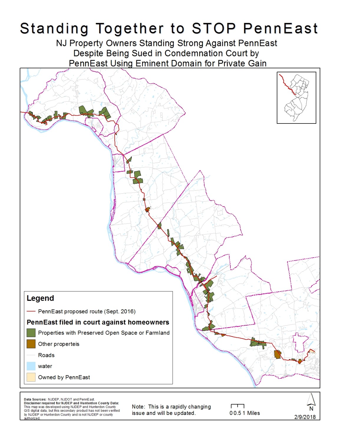
As you can see, opposition to PennEast does not exist in pockets, but instead is actually spread out along the entire route!
As more condemnation suits come in we’ll be updating the spreadsheet and the map graphic.

Published by