
So far looking through the NJDEP app, I’m struck by a few things:
- Useless stuff. PennEast has a lot of useless crud in many ears. Like the initial “Wetlands” maps that are useless for any real purpose.
- Copy’n’Paste. Most of the application is copy and paste, over and over and over and over and over and over and over again.
- Survey Data seems real. Some of the survey data seems solid. I haven’t done a comprehensive review of it, and I’m not an expert in most of these areas, but it seems to be hang together and matches people’s experience in their own back yards so to speak. So there is a solid baseline here. Which is good for us – the baseline is this project will be horrible for water quality and wetlands in NJ.That said I’m not sure about the endangered species surveys. That looks pretty rocky to me.
- PennEast analysis is crap. PennEast’s analysis in many areas such as alternatives is horrible. It’s contradictory, cherry picked, sometimes erroneous, and lacks consistency across attachments and appendices. It looks very hastily thrown together to meet an internal deadline. Probably because it was hastily thrown together to meet an internal deadline. Most of the information is dated May, June, or July of this year.
- Most FERC alternative routes are ignored. This application does not discuss most FERC-presented alternatives. It has really weird variations on some of those FERC alternatives that seem wholly manufactured to scare the DEP. And also seem to be crafted in such a way as to look as bad as possible (despite the proposed route being horrendous in and of itself). PennEast just like literally made up random alternatives to try to impress the DEP.
So that’s my thoughts so far. Now onto some of their so-called “analysis”.
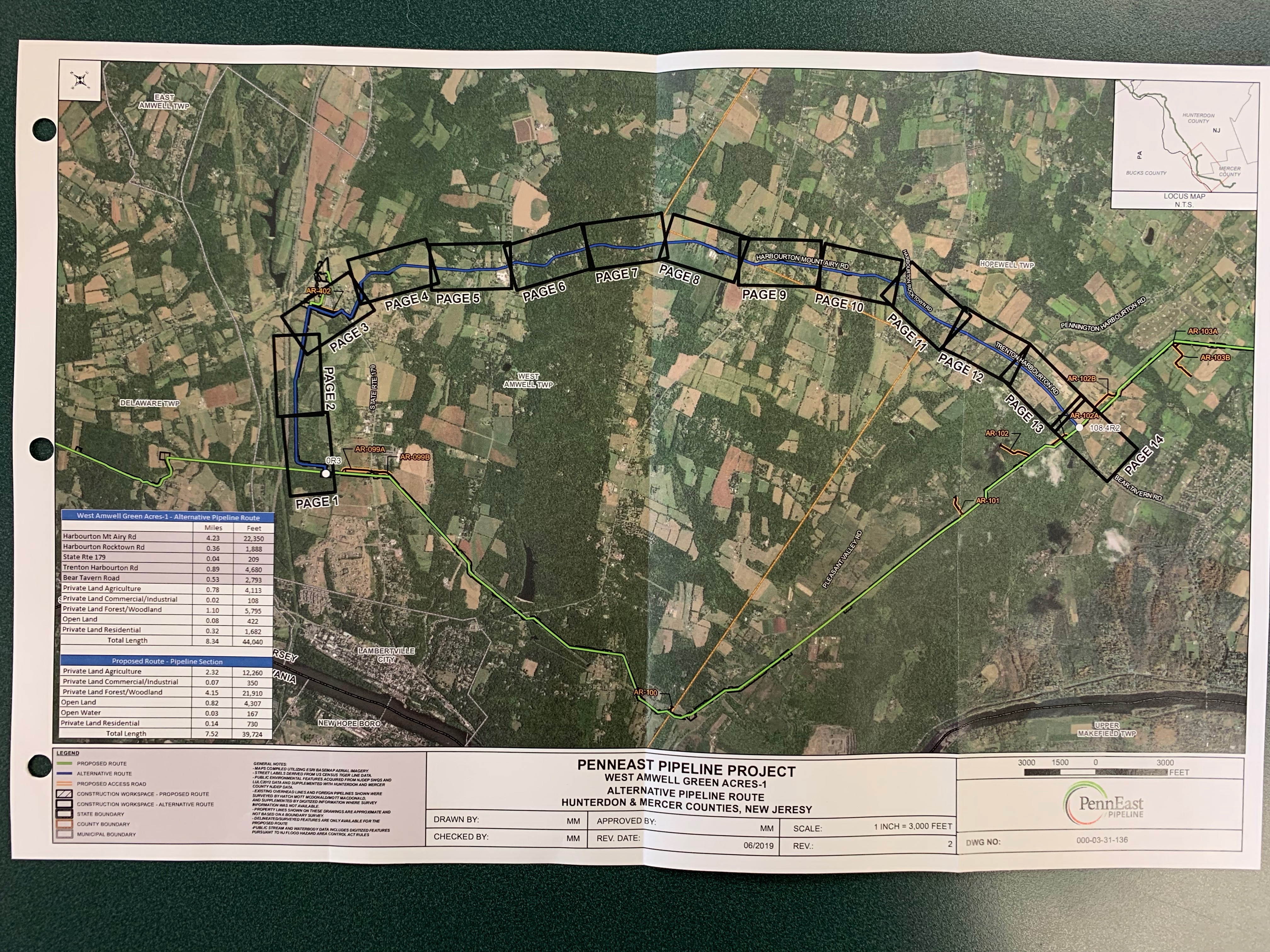
West Amwell “Green Acres” Alternative
I don’t know why they call it this, but they do this consistently in many areas. The “Green Acres” alternative is actually mostly the old 2014 original PennEast route that is far to the East of the current one.
Attachment K – Appendix B – West Amwell Green Acres Alternative
West Amwell Green Acres Alternative Map
As I said, this “alternative” is roughly along the lines of the 2014 route. Except that it’s not really. For some unfathomable reason, PennEast chose to just show roads in the general vicinity of the 2014 route as “the route”. I don’t know if they lost their old maps or what, but it does not match the 2014 route when you zoom in.
Worse, PennEast claims this route is “longer” than the proposed route. You know how they got there? By including a mile from the main line to the Lambertville Compressor Station (marked Page 1-3 in the overview map). In reality, this route is not longer because the current route has a lateral to the compressor station exactly where this “alternate” route starts. Yes, PennEast basically manipulated the “alternative” to make it look worse than it is (shocking I know).
The analysis is worse.
The alternative route crosses 10 wetlands vs. 29 wetlands for the current proposed route.
The alternative crosses 16 water bodies vs 32 waterbodies for the current route.
The traffic closures are all bogus and made up by PennEast.
They forgot to mention West Amwell Elementary and the child care site on 179 in the proposed current route when talking about schools.
Holland Gravel Hill “2” Alternative
An alternative discussed around Gravel Hill.
Attachment K – Appendix B – Gravel Hill Alternative
Again, I don’t know how they picked this alternative. It again seems to be designed to scare the DEP. Somehow the alternative is 1.5x more expensive.
More interestingly, the current route is projected to take 2 weeks to construct. The alternative route is projected to take 3 months. What the hell?!
Both routes have horrendous Endangered Species impacts.
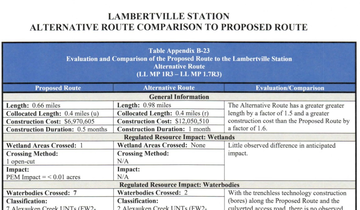
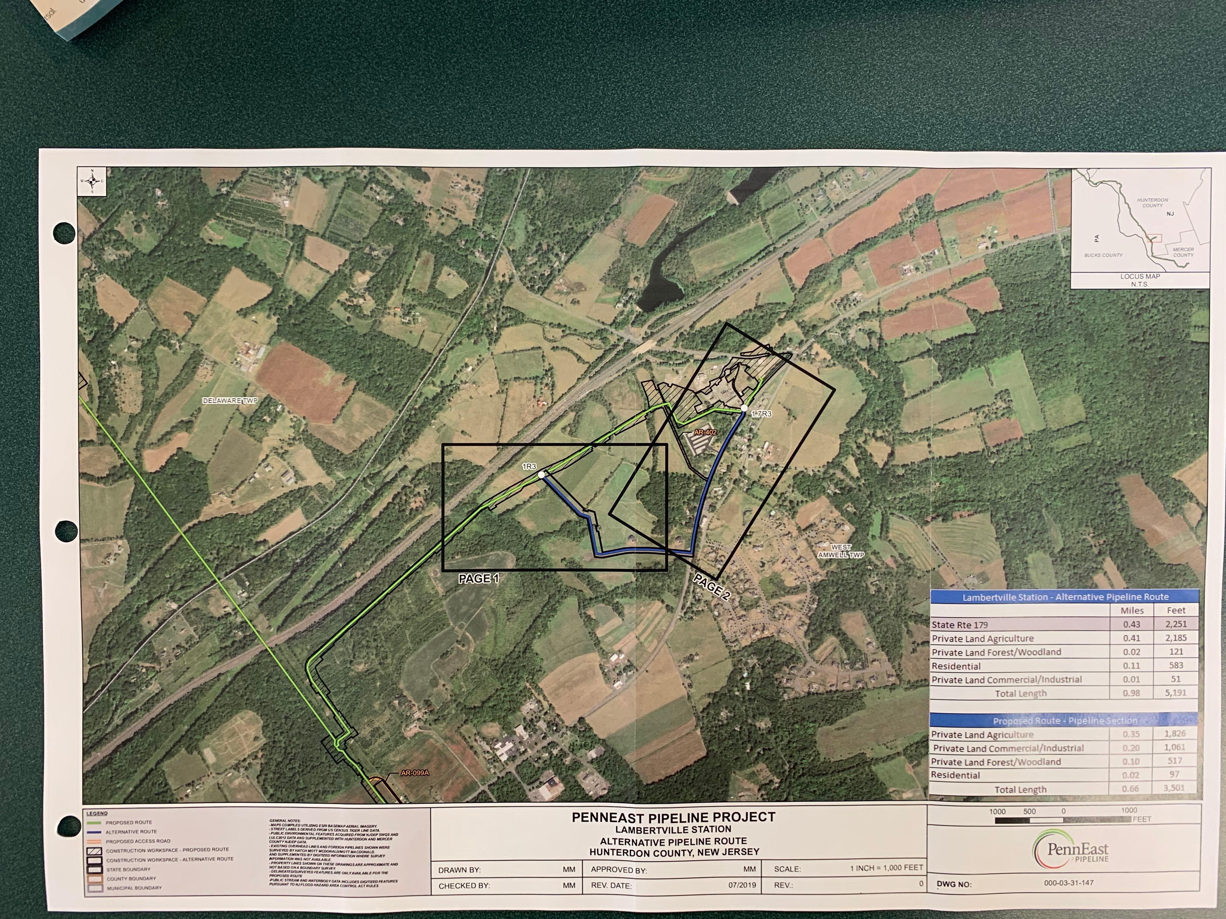
Lambertville Compressor Station Alternate Route
This is a really weird “alternative” that seems to go out of its way to go under a road for a few hundred feet near the Lambertville Compressor Station.
Attachment K – Appendix B – Lambertville Compressor Station Alternative
Lambertville Compressor Station Alternate Map
PennEast seems to have crossed its wires and had a small brain meltdown on this one. It’s 0.4 miles but claims it’ll cost $6.9 million to $12 million dollars to build, and imagines water body crossings that do not exist.
The talk about closing Route 179 to dig trench it up (without explaining why they need to trench up 179 at all). But then they say the current route will open cut “Old 518” and “Hewitt Road). Well, I’m pissed that they’re going to open cut my road, but more importantly Hewitt Road and Old Route 518 West are 3.5 miles from this site.
Baldpate Alternative
Here is Ye Olde alternative to the current Baldpate route.
Attachment K – Appendix B – Baldpate Alternative
This is another bizarre alternative that seems to try to run everything under roadways. Basically they are proposing to rip up Valley Road, Pleasant Valley Road, and a piece of Bear Tavern Road (!) to accomplish this.
Some details are of course wrong or left out. For example, it dings the alternative for going near Howell Living History farm, but neglects to mention the original route does that too.
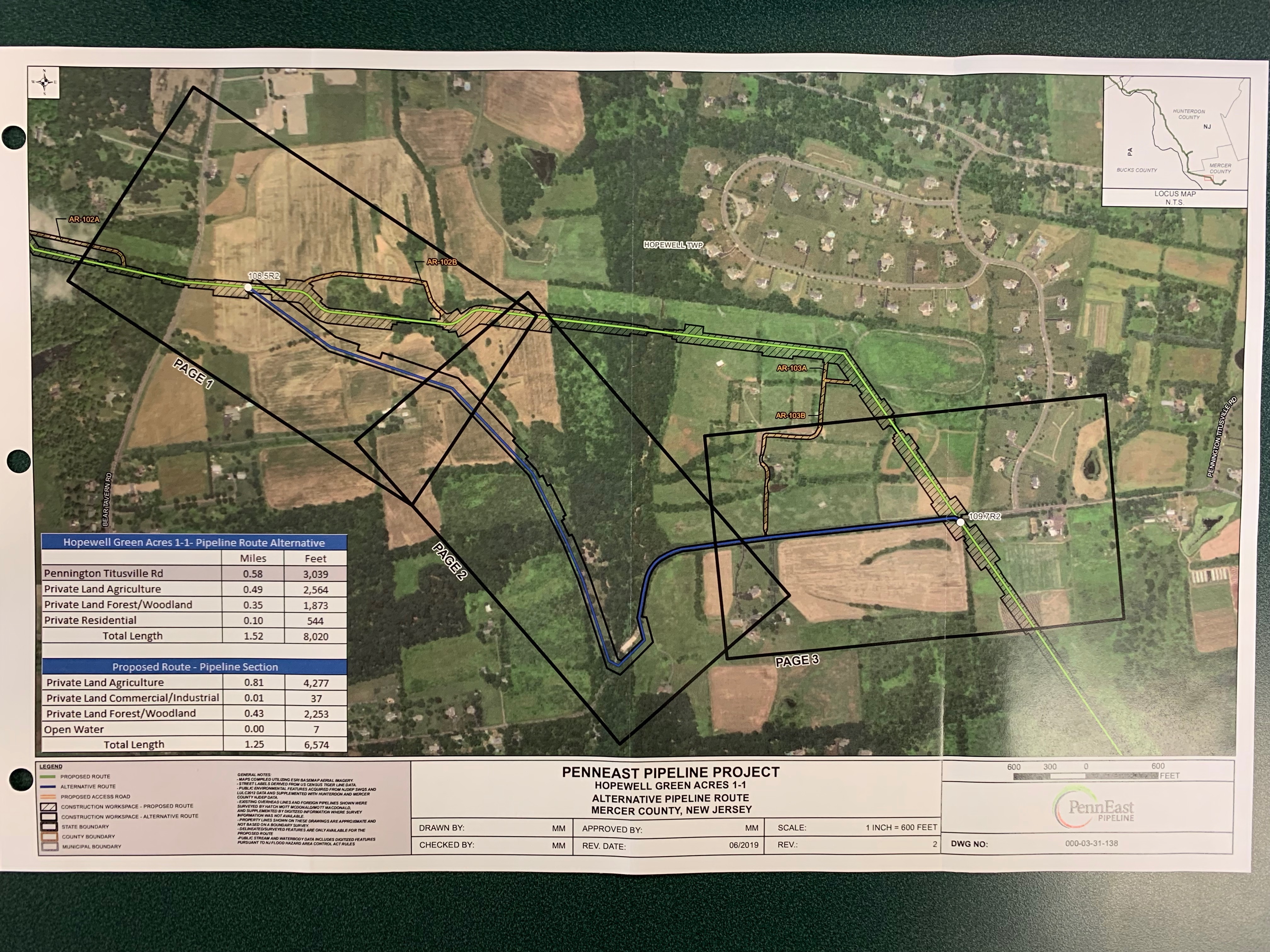
Hopewell Green Acres 1-1 Alternative
This one is in the vicinity of Pennington Titusville Road.
Attachment K – Appendix B – Hopewell Green Acres 1-1 Alternative
Hopewell Green Acres 1-1 Alternative Map
This is another one that bizarrely digs up a piece of a road for a few thousand feet for no apparent reason.

Mike, what a pleasure to read your analysis. Would you consider running for President? Nah, you are too good of a person to ruin yourself like that….. anyway, thank you!
LikeLike