
Since I wrote the entry on the proposed access road connecting to Stymiest Road, I’ve received a bunch of emails and also had a chance to check out the site myself.
Here’s the construction map to refresh people’s memories.

As it turns out this is one of those dual-named roads that runs between West Amwell and Lambertville. It looks like in West Amwell the road was renamed in honor of a previous Police Chief for the township. Searches for his name in the township reveal the obituary of his wife, who was listed as living on “Old Rock Road” in West Amwell.
The Lambertville side is called simply “Rock Road”.
I took a drive up there today to see what it was like, here is how far I went, and then took pictures coming back down.

And here’s what the road looks like up there:
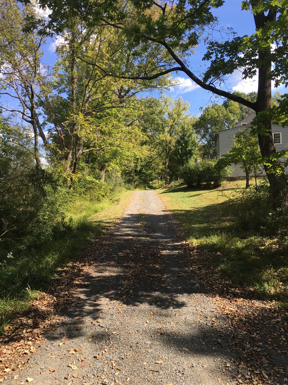
As you can see the road is all gravel and a narrow single lane, it terminates at this house.
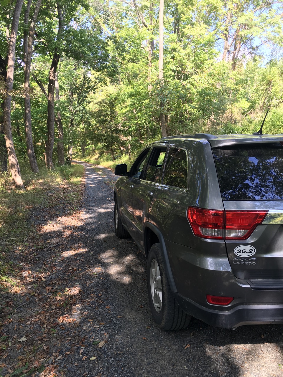
Going back down you can see a moderate slope, and there are many twists and turns (it twists to try to stay on a rough ridge line trending down).
Coming down near the bottom you see a sharp turn to the left and a warning of a “one lane bridge”.

Turning the corner you do indeed see a very narrow two lane stone bridge, shored up with some modern steel.

If you turn around from where I’m standing here you’ll see a sign. This is a sign that Sean Pfeiffer of West Amwell emailed me about. You see, this isn’t just any tiny road named after a former police chief from the 1980’s. It has some history somewhat older than that as well.
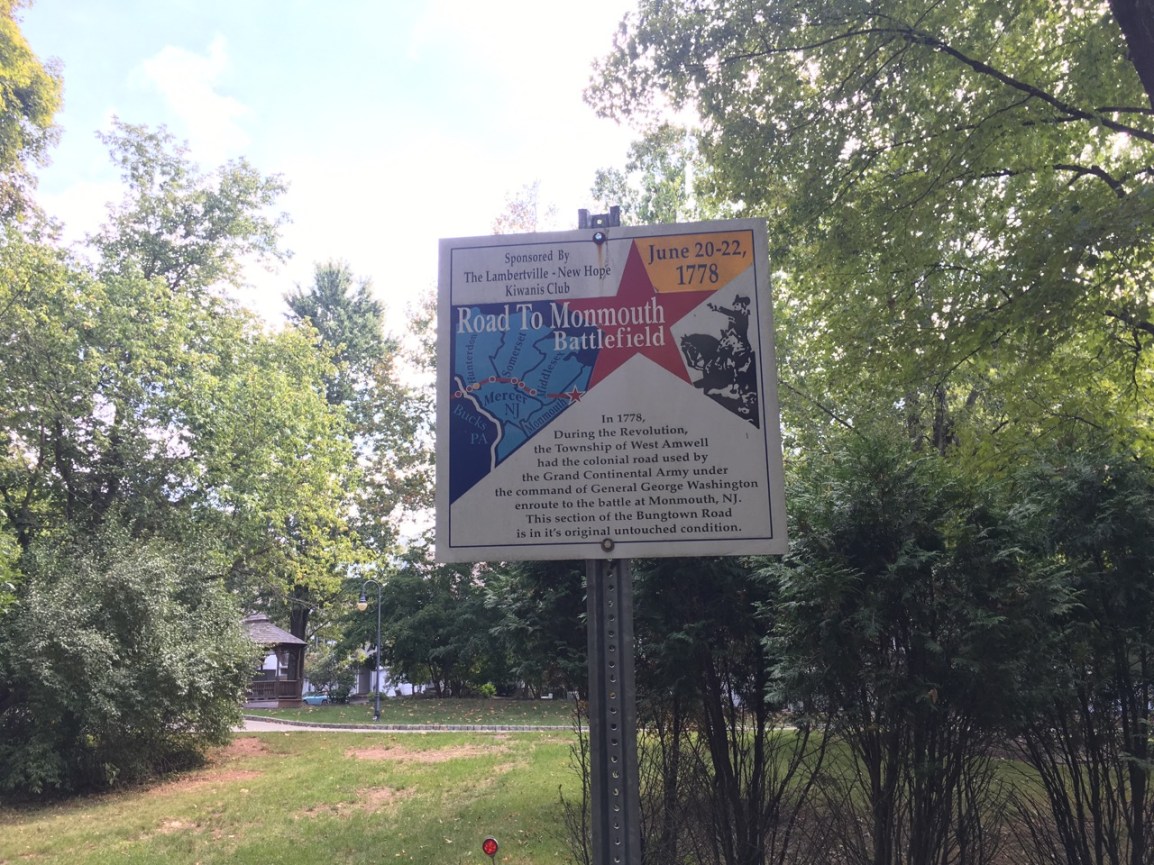
The sign reads:
In 1778, during the Revolution, the Township of West Amwell had the colonial road used by The Grand Continental Army under the command of General George Washington enroute to the battle at Monmouth NJ. This section of the Bungtown Road is in its original untouched condition.
As it turns out, the Bungtown Road was a big deal for Lambertville and the region:
There is a notice about this book in the West Amwell Township committee meeting minutes from 2015:
John and Barbara Hencheck apprised the Committee of the availability of their limited edition book The Road Along the Rocks 1758: “The Bungtown Road.” Closed in 1872, this long abandoned road, located in West Amwell Township, is most likely the most historical road in the nation, per their research. The cavaliered stone wall uncovered along the roadway is second to none in its construction and was most likely built around the time of the French and Indian War and the Field Barracks in Trenton. The importance of the peach crop to the local economy, with the transport of the resultant product–barreled distilled spirits–over this portion of road to the Raritan River, as well as the use the road during the Revolutionary War by notables of that time period, including those who marched to the Monmouth battlefield, was briefly overviewed. This road is a candidate for the U.S. National Historic Landmarks program. The Committee requested that a note be placed on the website concerning the book’s availability.
So this is where PennEast wishes to build an access road. Connecting to a tiny one land gravel road on sloped land and many twists and turns, with a minuscule one lane bridge at the entrance to it, and which is part of what one historian calls “the most historical road in the nation”.
And then connecting down onto nearly as small Quarry Road:
Imagine earth movers, huge trucks carrying 50′ lengths of 36″ pipe, and support vehicles all moving through this area.
Now perhaps you have an idea why so many people think so little of PennEast.

Published by