This post shows the differences between the February 2016 route and the September 2016 route, and also the new HDD site impacts from the September 2016 route.
This post covers NJ. There will be a followup for PA. I’ll also be covering access road impacts in a separate post as well.
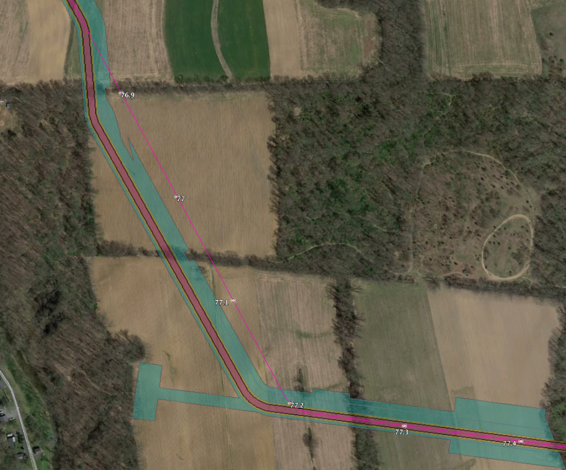
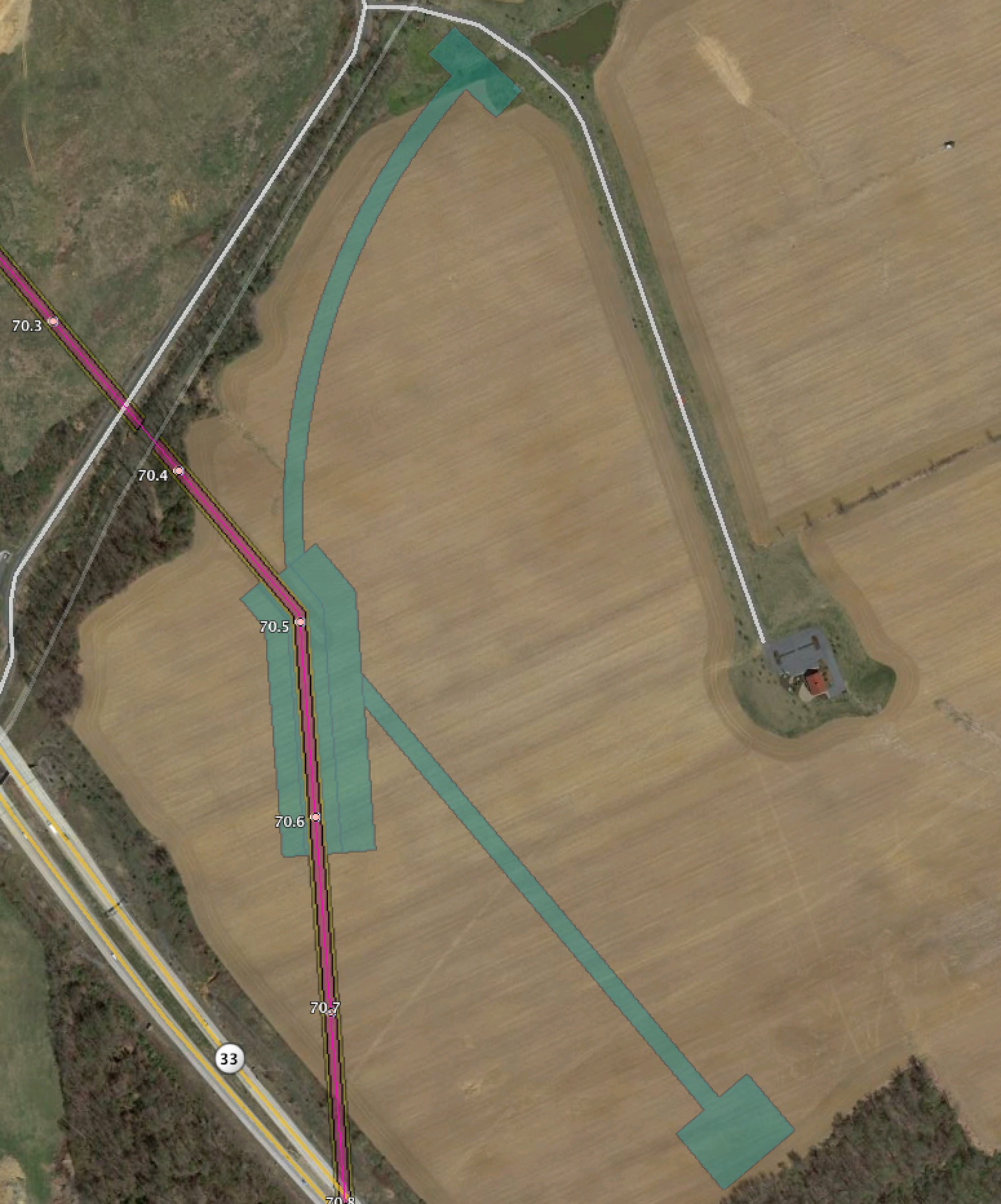
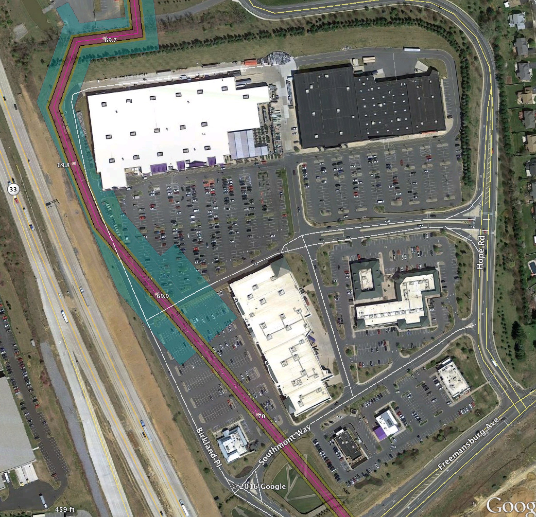
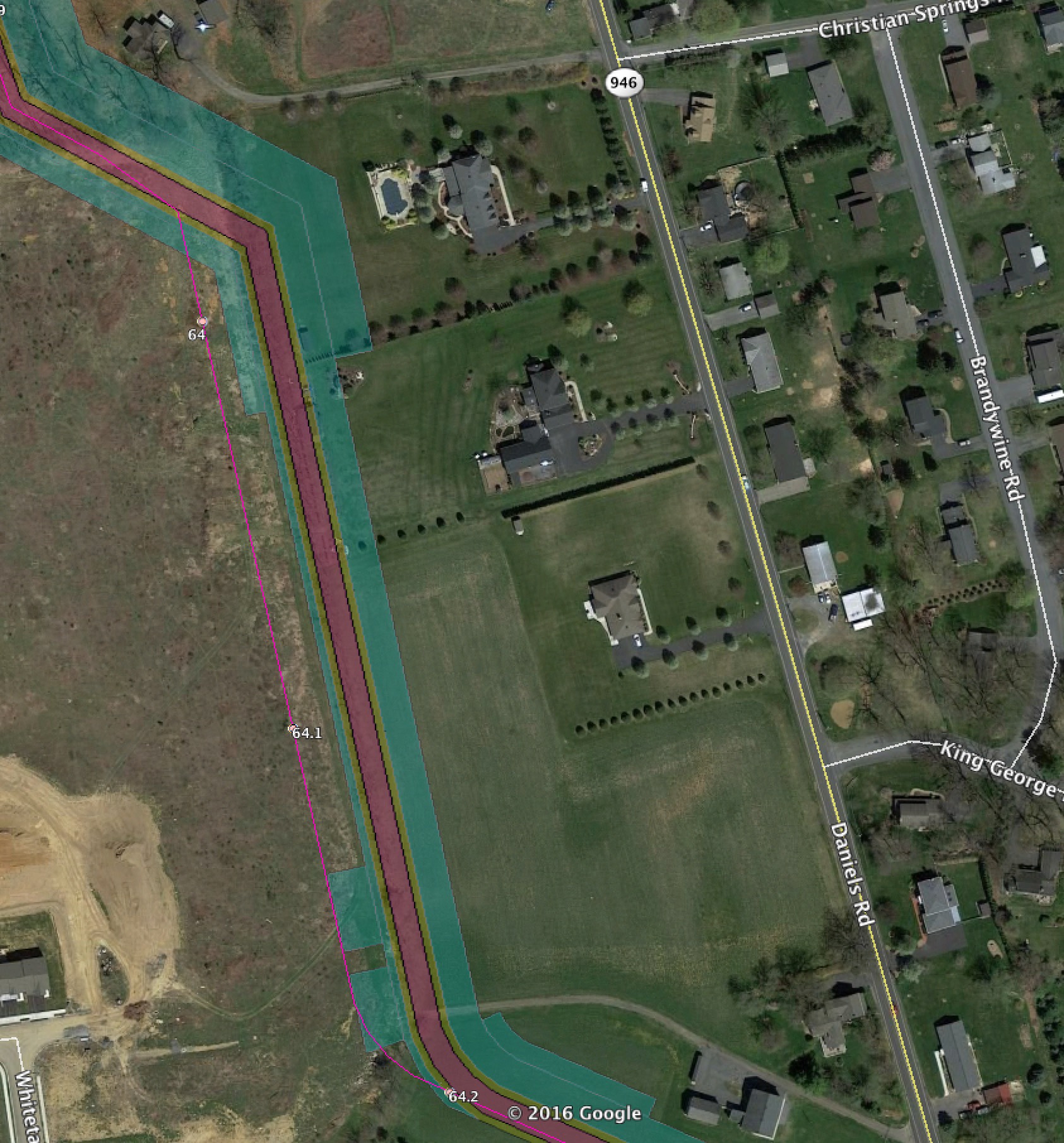
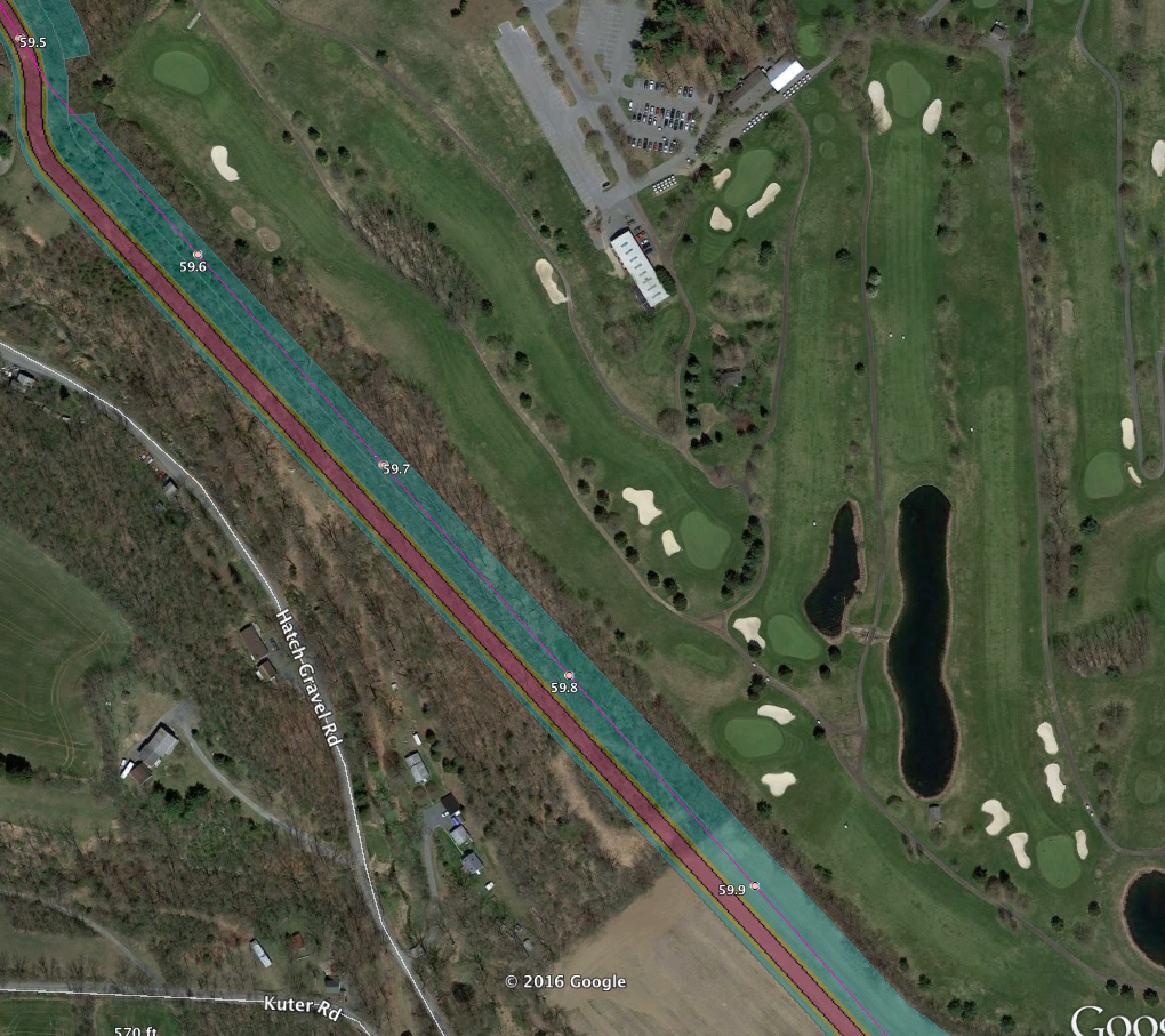
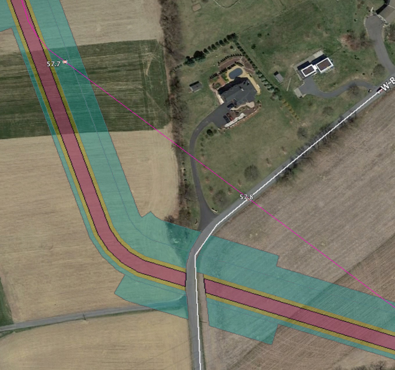
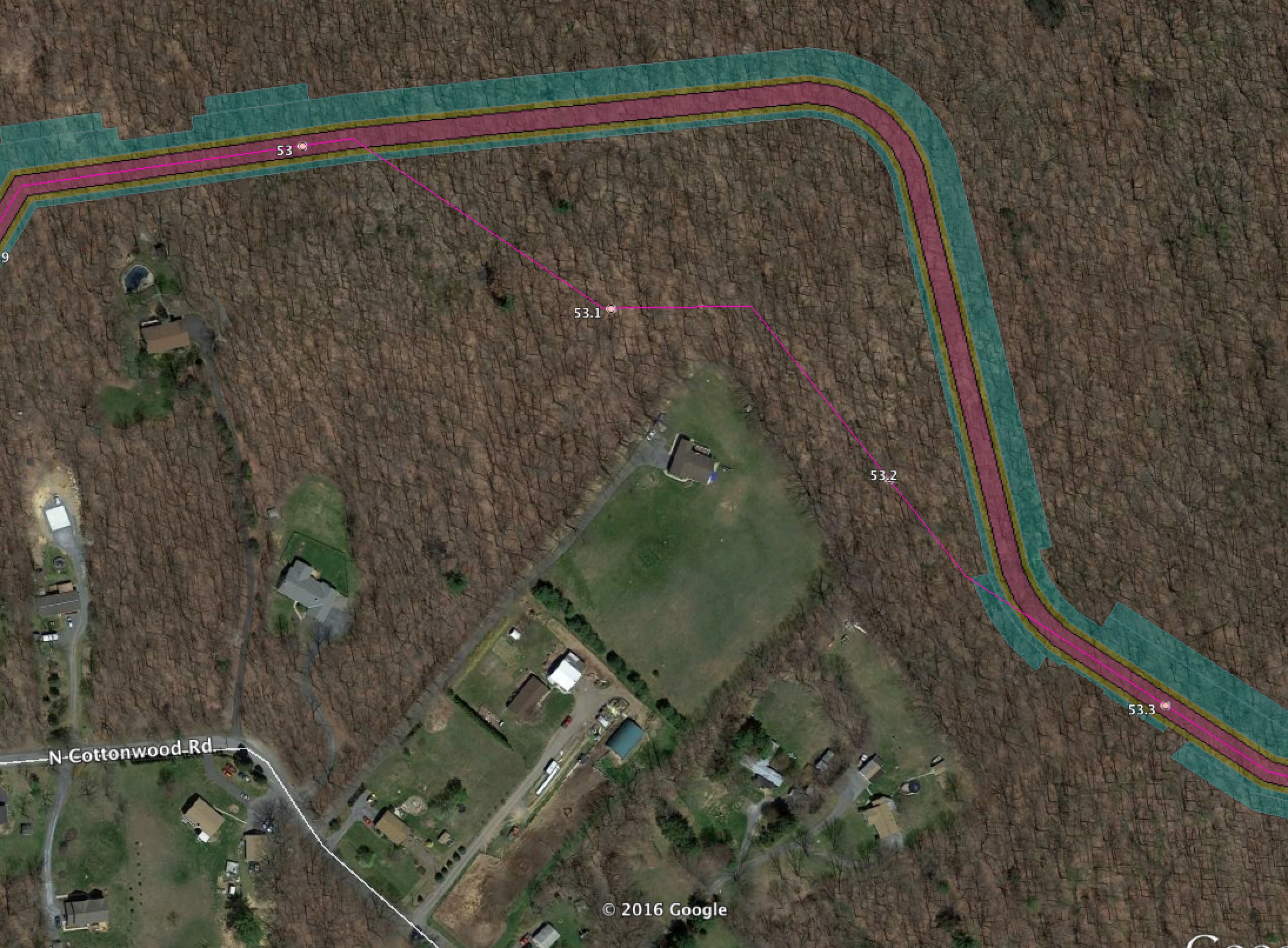
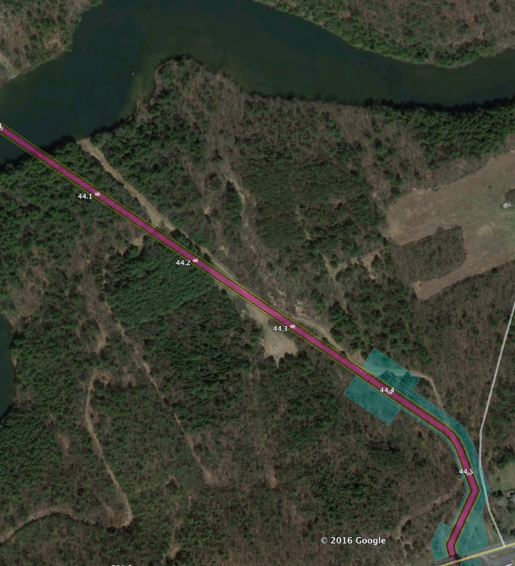
In these posts the bright pink line with the milepost numbers is the February 2016 route. In some cases we include the 400′ survey corridor for that as well.
The new September 2016 route shows the actual ROW in faded pink and orange, and temporary work spaces in cyan.
Hopewell NJ Scotch Road HDD Site Impact
This shows the HDD setup site south of 546 near Scotch Road. These HDD impact pictures show you that HDD isn’t “free”. There’s an impact in large setup spaces that are clear cut.

Hopewell NJ Scotch Road HDD Site Impact 2
The other end of the impacts.

Hopewell NJ Bear Tavern Road change
The route is moved slightly south.

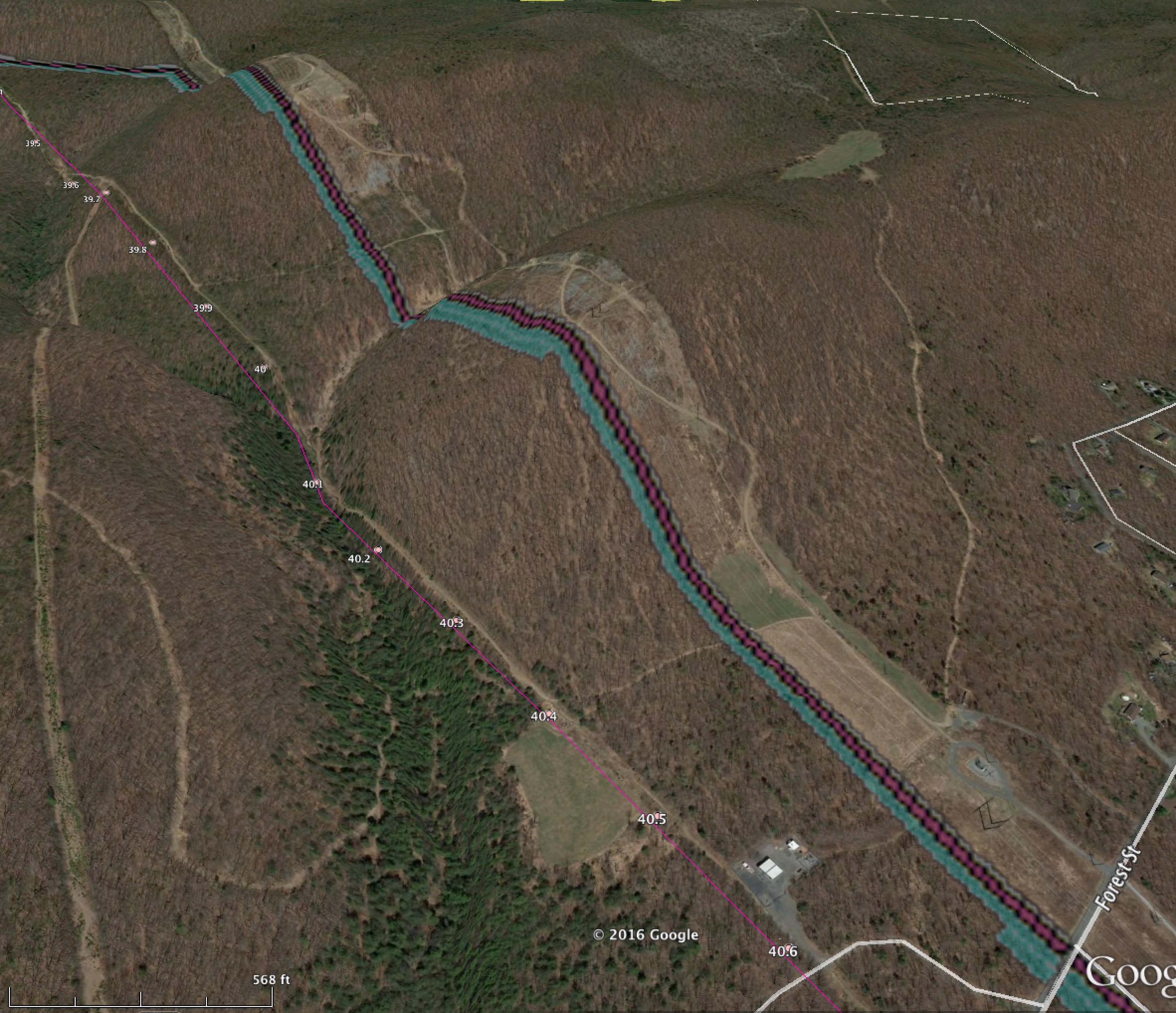
Hopewell NJ Baldpate Mountain HDD site impact
They’re going to clearcut that big cyan square for the HDD under Pleasant Valley Road/Moores Creek.

Hopewell NJ Baldpate HDD Impact 2
This is the other end of the Baldpate HDD site, in the middle of wetlands.

West Amwell NJ Old Route 518 Change
Here the route is shifts to the East about 150 feet on the southern portion of the map, and 50′ to the west on the top portion. This helps PennEast impact two houses more directly, and also causes maximal tree cutting damage in the area.

West Amwell NJ Suez water site
The route is shifted approximately 50′ to the west here, resulting in even more tree cutting on steep slopes and wetlands impacts. At least it’s a little further from the Swan Creek Reservoir dam. It also appears to still cut the water pipe.

West Amwell NJ Route 179
The route is now about 150′ east of the previous one

Delaware Township NJ Brockville Hollow Road HDD Site
This documents the new HDD entry/exit point for the Brockville Hollow site and associated route change.

Delaware Township NJ Lower Creek Road HDD Site Impact
Another new HDD site, this one is Lower Creek Road.

Delaware Township NJ Rosemont Ringoes Road HDD Impact
The other end of the HDD site from above and associated route change.

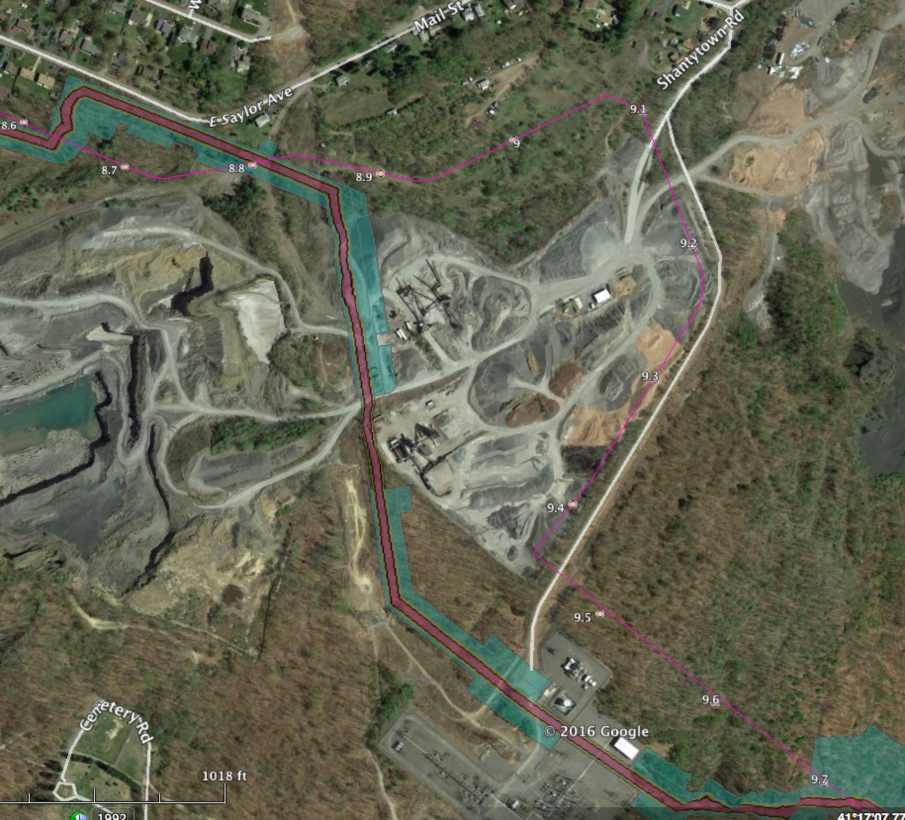
Delaware Township NJ Sanford Road HDD Site
A huge impact from HDD entry/exit on a farm house on Sanford Road.

Delaware Township NJ Hewitt Road HDD Impact
The other end of the above HDD work.

Kingwood Township NJ South of Featherbed Lane HDD Impact
Site impact in cyan below Featherbed Lane.

Kingwood NJ Kingwood Lockdown Road new Impacts
Huge construction zone taking out trees south of Kingwood Lockdown Road.

Kingwood NJ North o Kingwood Lockdown Road HDD Impact
Impact site from HDD entry/exit and associated route change

Kingwood NJ Kingwood Road/519 HDD site impact
Another HDD site impact

Holland Township NJ Milford Warren Glen Road/519 HDD Site Impact
New HDD and associated route change

Holland NJ Reigelsville Milford Road
Route 75′-100′ north of previous route

Holland NJ Route 627 Route variation
One of the biggest changes in NJ, the route has moved North about 1,300 feet. PennEast keeps waffling between these routes here. It is clear there is NO good route through this very sensitive and difficult area and PennEast’s constant waffling indicates this.
It also shows PennEast’s statements of “no new landowners” are impacted is false. The route here is completely different from the prior one.

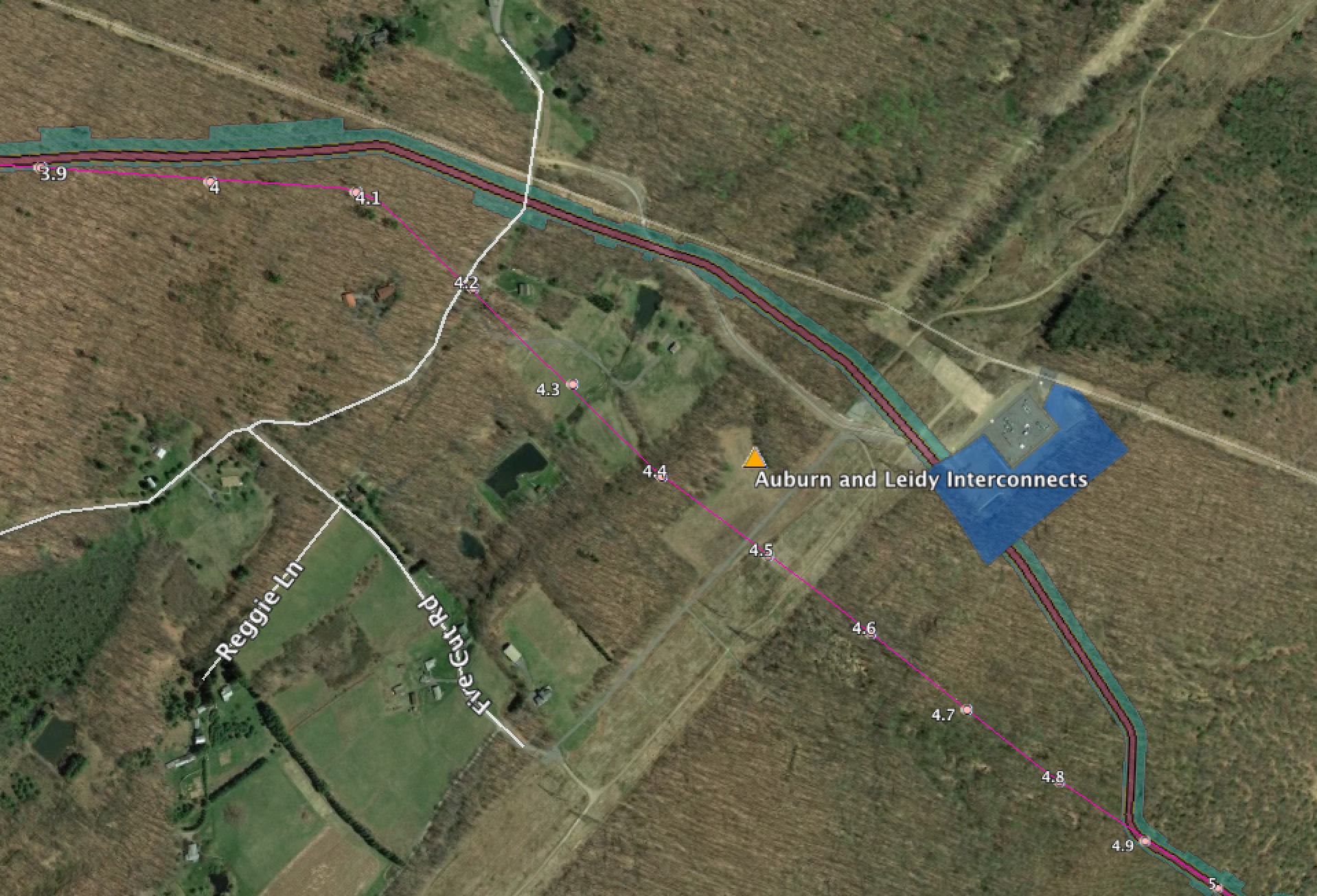
Holland NJ Gilbert and Elizabethtown Interconnect Closeup
A closeup of the Gilbert generating plant area. The lateral is now completely different from the previous one.

Running these sites is getting expensive. If you want to help out with the hosting and other costs of running thecostofthepipeline.com along with pipeinfo.org, then please take a look at the donate page. Thanks!