The Cost of Horizontal Directional Drilling

Horizontal Directional Drilling, or HDD, is sold by pipeline companies as a panacea for a host of problems with pipeline routes.  Usually natural gas pipelines are built by trenching down in the ground 6-9 feet deep, then covering up the pipe once it’s installed.  HDD involves drilling a bore hole under ground instead, and then either pulling or pushing the pipe through that.  The upside is there’s no trench and no need to clear cut.  The downside is that it’s often very difficult to do, its success depends upon geology, and when it fails it can be very, very bad indeed.  Plus, there is a very large construction impact at the entry/exit points where the HDD enters/exits the ground.

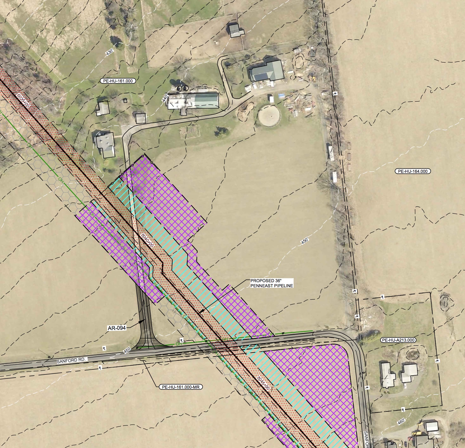
One such spot is Carla Kelly-Mackey’s farm on Sanford Road in Delaware Township.  Carla is a member of HALT PennEast, and has been staunchly against the project from the beginning.  As route change after route change has come it has danced slightly all around her farm.  With the most recent route change, her front door is now proposed to be home to an HDD construction pad.

Here are the latest plans for her farm:
sanfordroadkelly-mackeyfarmplans

As you can see, they plan on using her driveway as a construction access road, and then staging the HDD site across her driveway and in her front yard.  Here’s what it looks like in Google Earth:

sanfordroadgoogleearthview

I used the Google Earth measuring tool to check the distance from the construction zone to her house – as you can see it’s less than 50 feet!

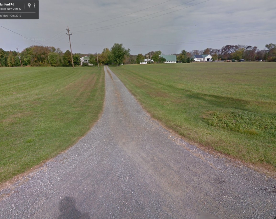
The “road” they’ll be using:
sanfordroaddriveway

Now what will all this HDD construction look like?  We don’t know for sure yet, but here’s a sample of a 36″ pipe being HDD’d down in Florida:

In that case of that project, the construction crew worked 24/7 to get the job done (it was blocking a freeway express ramp). Working non stop day and night it took 10 days to complete the HDD installation. They used something called a “300-ton Herrenknecht Pipe Thruster” to get the job done.  Hopefully PennEast will not be banging on that pipe in three in the morning, so who knows how long this job will take?  According to the HDD plans they will be boring and pushing/pulling for around half a mile…..

Imagine THAT in your driveway and 50 feet from your front door.


Running these sites is getting expensive.  If you want to help out with the hosting and other costs of running thecostofthepipeline.com along with pipeinfo.org, then please take a look at the donate page.  Thanks!

Donate with PayPal

Another Disastrous Access Road

Earlier in the week the disastrous access road proposed to connect to Stymiest Street in West Amwell was described.  There PennEast proposed to build a temporary construction road charging straight up the mountain and cause severe runoff and erosion issues.  Not to mention it was connecting to a tiny one lane gravel road that in turns connects to tiny Quarry Street in Lambertville.

But that isn’t the worst one proposed.  Oh no, there are more!  Over in Delaware Township, the plans have changed around Lower Creek Road from open trenching to a Horizontal Directional Drilling “solution”.  These are sold as being much better for the environment (a claim many dispute, but that’s the topic of another story).  In this case, the HDD proposal means they need large staging sites on either side of where they intend to drill.  South of Lower Creek Road they propose a staging site on a neighboring farm of T.C. and Joe Buchanan.  And to get there, they propose to use their driveway as a construction road.  Yes, that’s right.  Here are the plans:

roadplanslowercreekroad

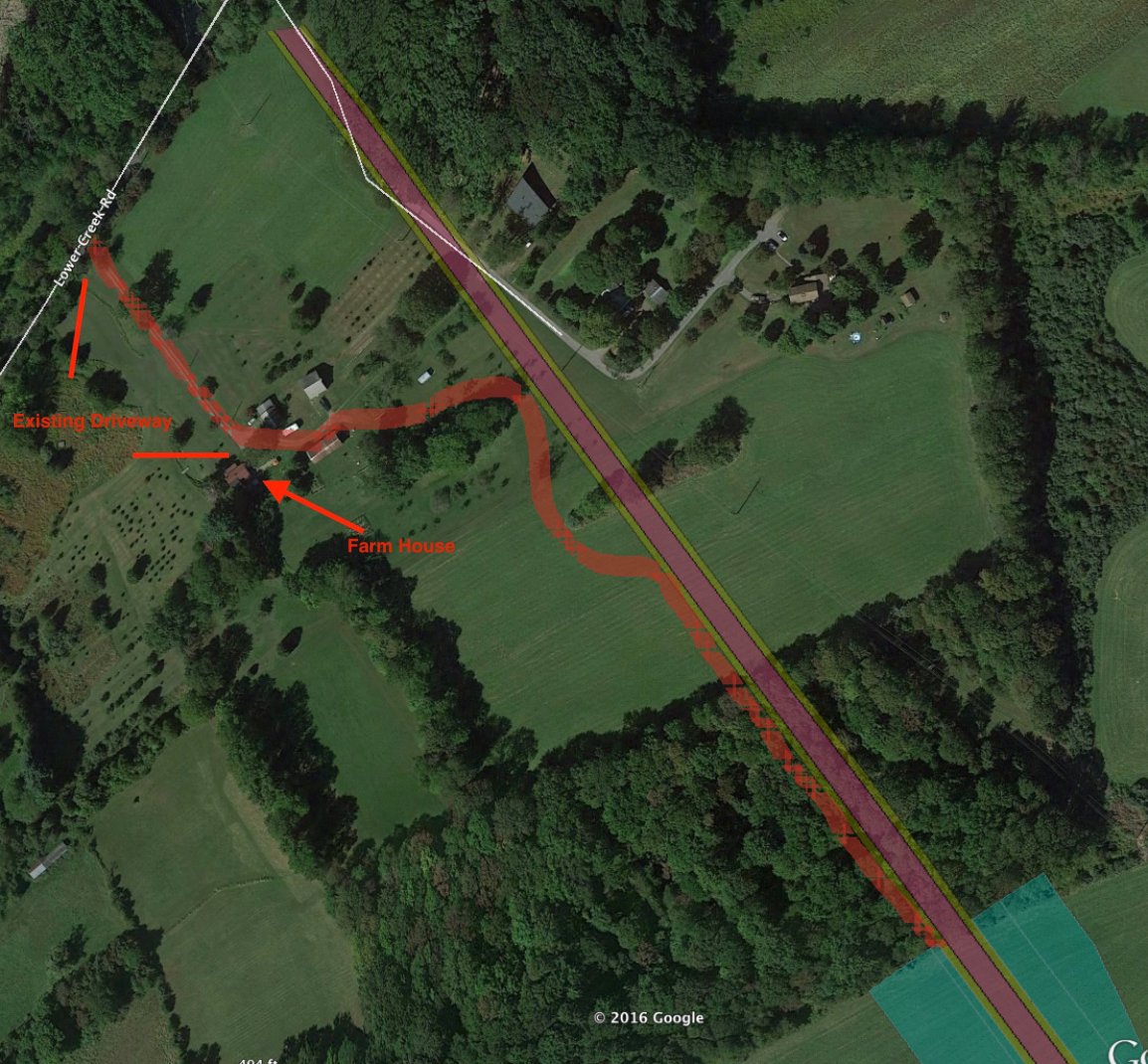
That dark gray wavvy line is the proposed road. You can see it snaking between the farm houses and buildings on the farm, then running along the pipeline route and terminating at the HDD staging site.

Here’s a google earth map showing the same area:

lowercreekroadaccessroad

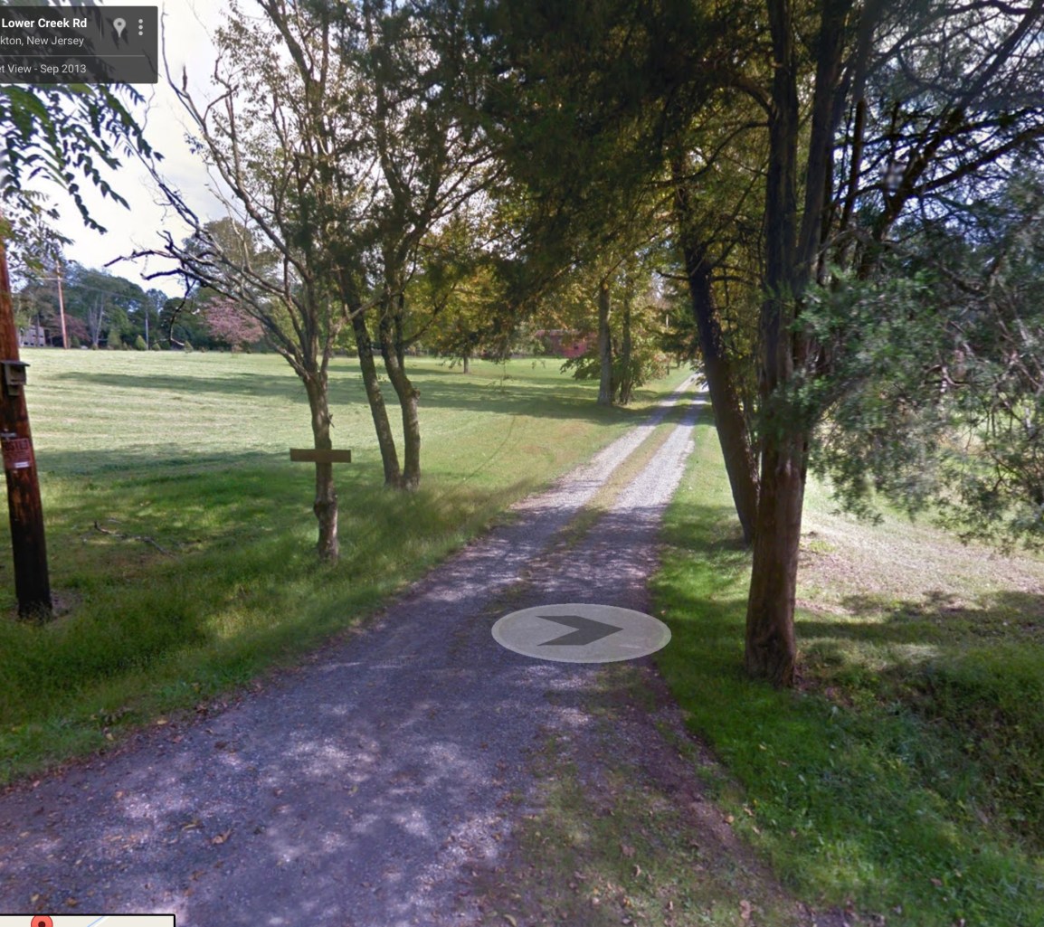
As you can see from the plans and the pictures, what they are proposing is to go up T.C. and Joe’s existing gravel driveway.  Here’s what that driveway looks like:

lowercreekroaddriveway

This is a typical country farm one-lane driveway.  They’re going to expand this to be 50′ wide, taking out trees on both sides.  Look back at the plans, and you’ll see it running within about 10′ of their farm house.  It runs right across their fields, making them useless.

The HDD itself goes down about 80′ – right at the level of everyone’s wells in the area.  TC tells me it’s going right through some wells.

Imagine having machinery like this lumbering 10′ away from your house:

As a final insult, all this information came out AFTER the DEIS was issued.  So TC and Joe don’t even have an opportunity to comment or object in the official process.


Running these sites is getting expensive.  If you want to help out with the hosting and other costs of running thecostofthepipeline.com along with pipeinfo.org, then please take a look at the donate page.  Thanks!

Donate with PayPal

Improved Map for September 2016 Route Changes

Every time PennEast releases a set of maps, they do it differently.  Every. Single. Time.  The result is that we see a very inconsistent view of the route over time, and it is frankly frustrating as hell.

The map I published a few days ago was the first to include construction work spaces, and also the actual Right-of-Way.  In that respect it was a big improvement.  But it lacked the center line, mile markers, and the 400′ “study corridor” mandated by FERC.

Fortunately (?), PennEast has been sharing different versions of their maps with different parties. In particular, the general public was given one set of maps (the one I distributed), and then municipalities were given a different map.  I was able to combine the best features of both into a new map that is greatly improved.  The links here and http://pipeinfo.org have been updated with the new map.  Here it is:

https://www.google.com/maps/d/viewer?mid=1HseJh7rKferTARPMVWrOQvIIvb8

The map features include:

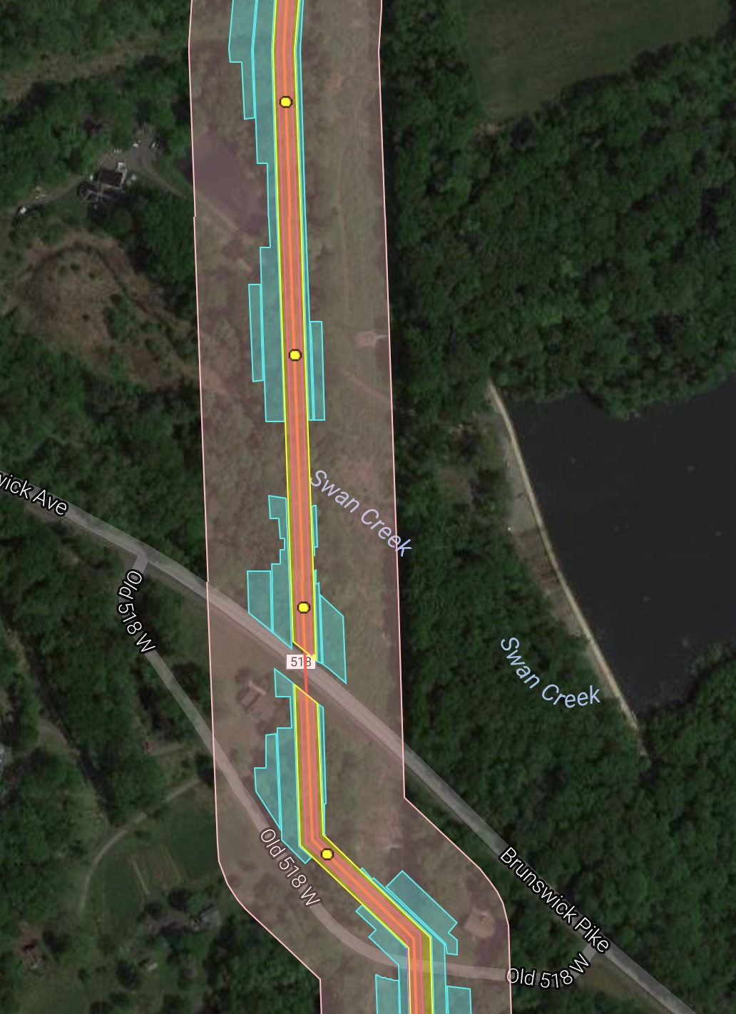
  • All features are made semi-transparent so you can see what’s underneath them
  • Pipeline centerline
  • Permanent Right-of-Way
  • Mile markers (clickable yellow dots)
  • Construction areas (cyan)
  • 400′ study corridor (shaded pink)
  • Permanent above ground features (compressor stations, launchers, etc)

A sample is shown below:

compositemapsample


Running these sites is getting expensive.  If you want to help out with the hosting and other costs of running thecostofthepipeline.com along with pipeinfo.org, then please take a look at the donate page.  Thanks!
Donate with PayPal

Map: Baldpate Access Road

Yet another access road planned for PennEast.  This one goes from Pleasant Valley Road onto their site on Baldpate Mountain.

baldpateaccessroad

The access road is the dark grey path on the upper left of the map snaking up to the pipeline construction area.

Note that the picked one of the steepest possible slopes for this road.  Here’s approximately where it is on Google Earth with 3D terrain turned on:

baldpateaccessroadgoogleearth

As you can see, the proposed access road goes up the side of the mountain and then back down to get to the pipeline construction area.  This is the second steepest slope on Baldpate that I can see, and PennEast seems to have made it deliberately as awful as possible.

And this is on top of the existing impacts we knew about.  Here’s a direct overhead shot of the site:

baldpateoverheadimpacts

You can see all of those construction work spaces digging into the existing old growth trees, and then the helpful access road to make it even worse.

As a final note, I’ll show what Fairfax Hutter dubbed the Baldpate “Mohawk”.  The so called “colocation”, that really isn’t.  In this case, the pipeline has to be sited far enough from the high voltage lines that the construction is in an entirely new corridor on Baldpate, with a thin area of trees between the power lines and PennEast e.g. the Mohawk.

baldpatemohawk

My son might think this is cool, but pretty much everyone else is going to hate this.

Maps: Route differences and HDD Impacts in PA

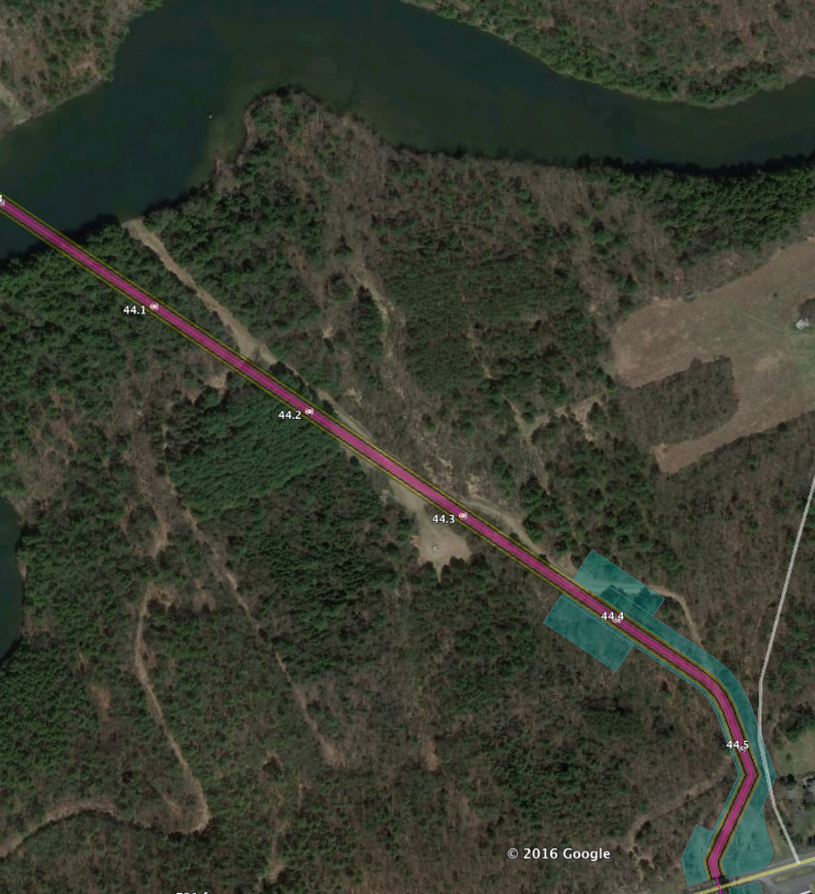
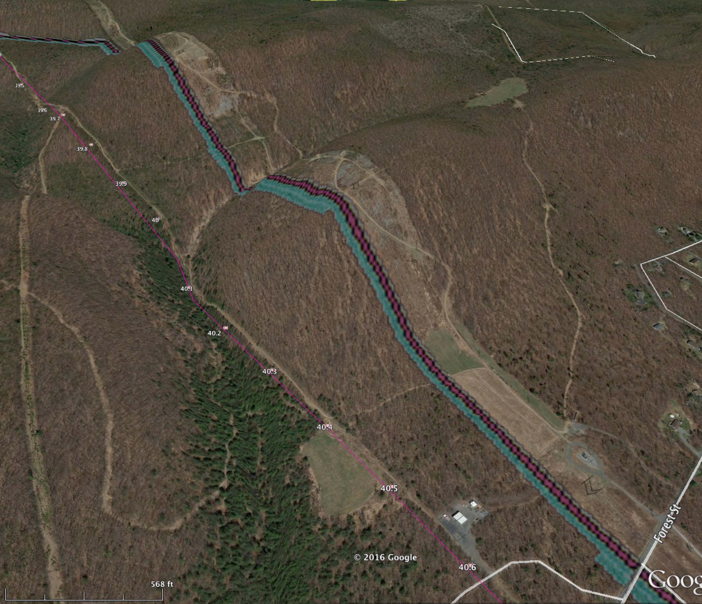
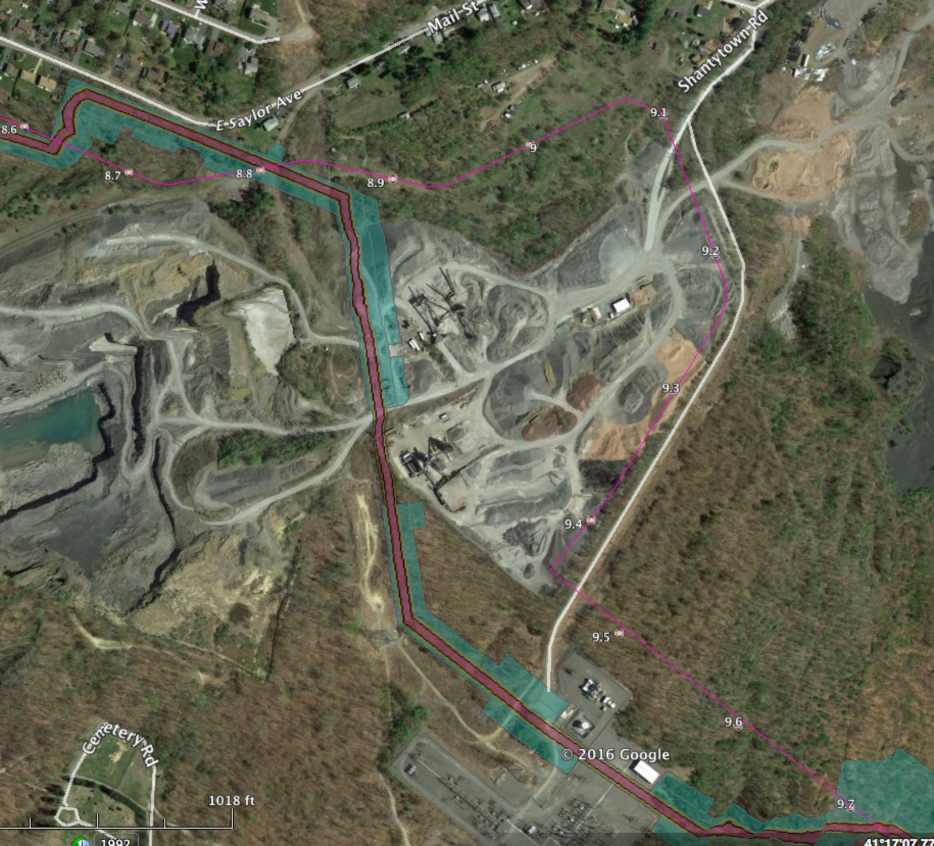
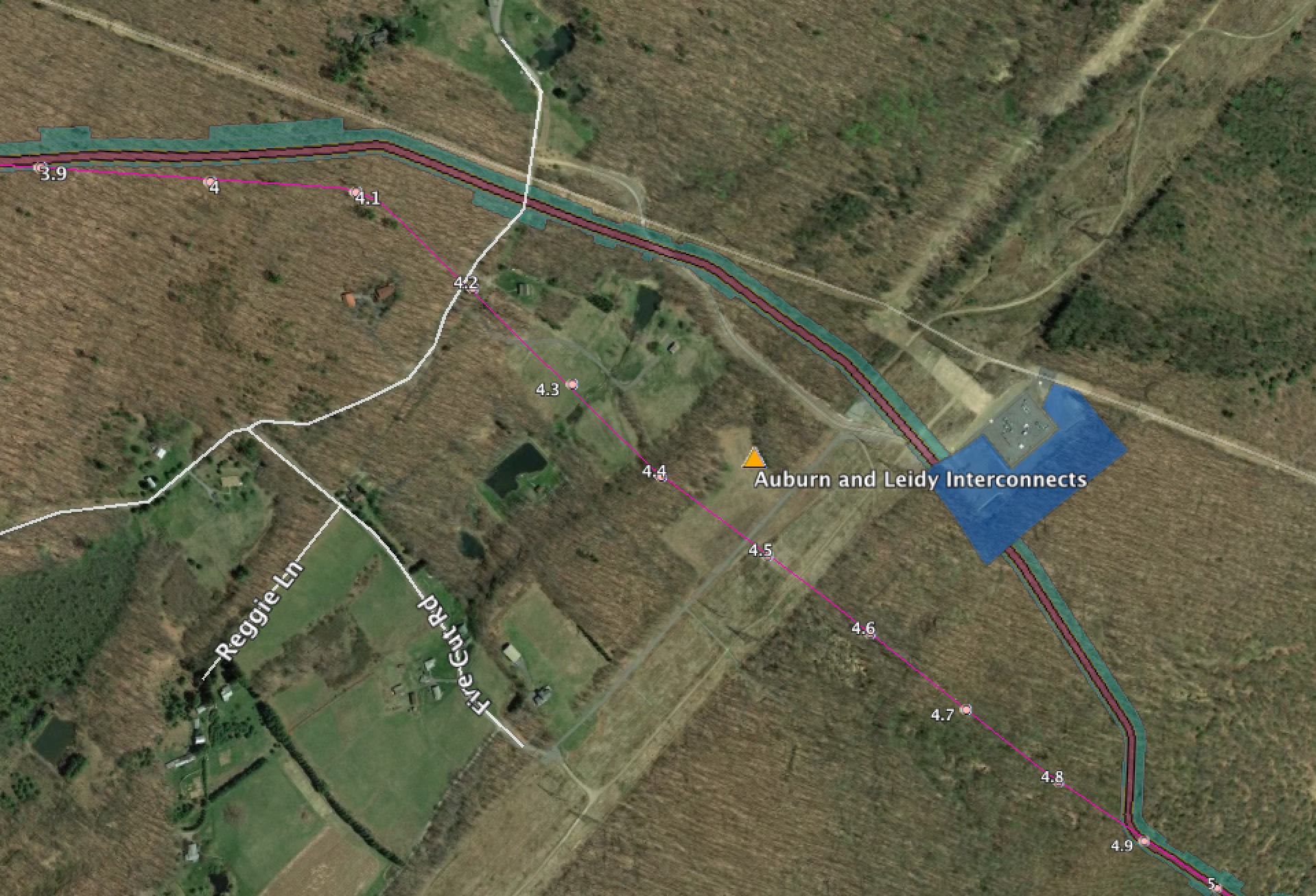
This post shows the differences between the February 2016 route and the September 2016 route, and also the new HDD site impacts from the September 2016 route.

This post covers PA.  There was also one for NJ.  I’ll also be covering access road impacts in a separate post as well.


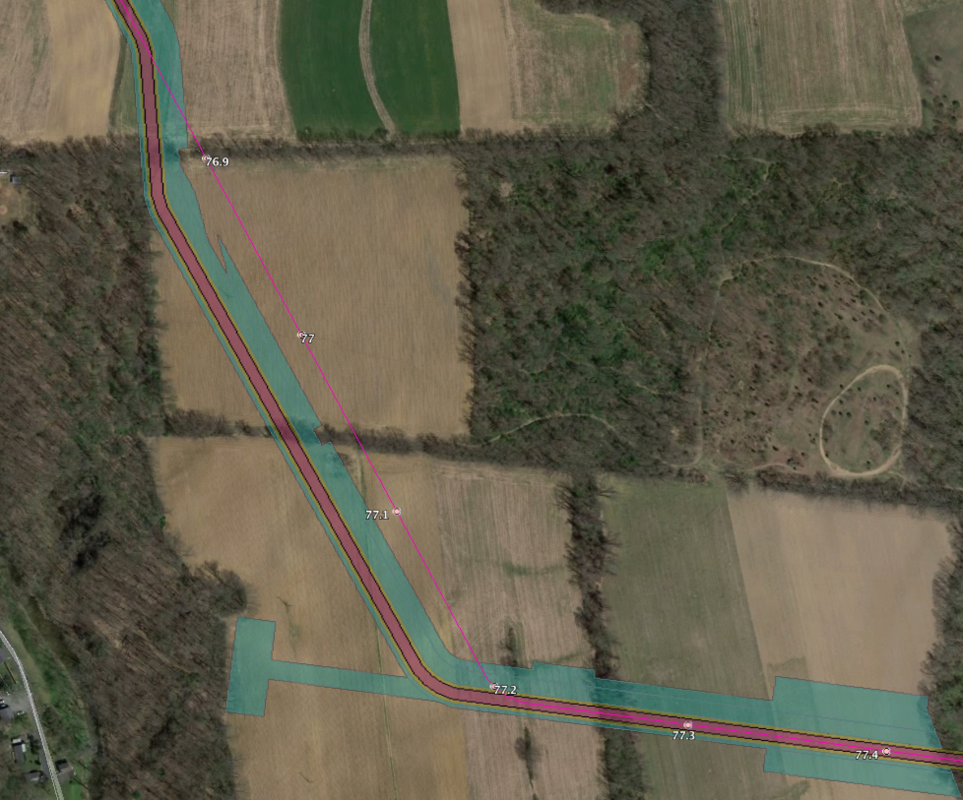
In these posts the bright pink line with the milepost numbers is the February 2016 route. In some cases we include the 400′ survey corridor for that as well.

The new September 2016 route shows the actual ROW in faded pink and orange, and temporary work spaces in cyan.


PA Red Bridge Road

changeparedbridgeroad

PA Hexenkopf Road

A large change near hexenkopf

changepahexenkopf

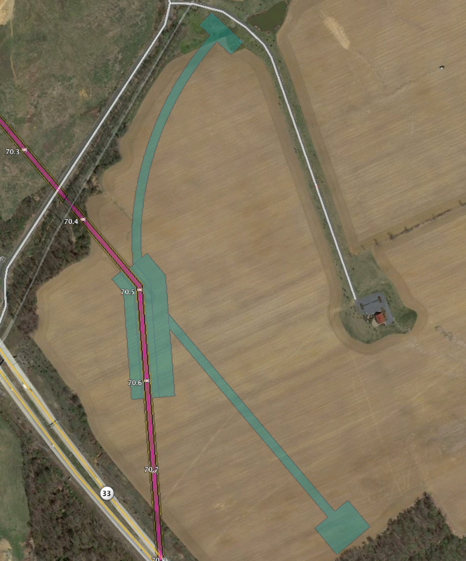
PA Route 33 additional workspaces for HDD

More workspace for HDD south of the shopping center.

changeparoute33additionalspaces

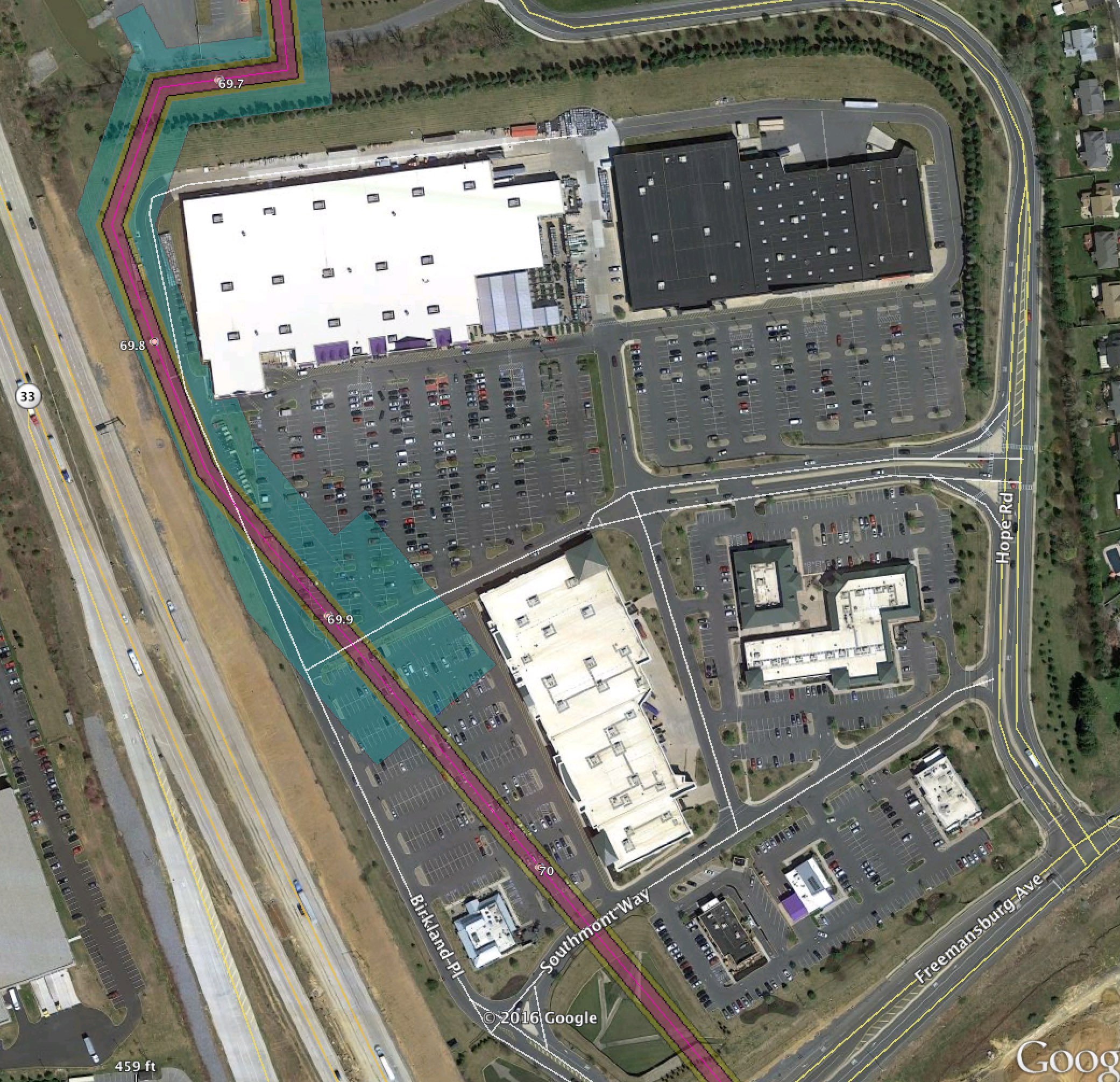
PA Route 33 Lowes Shopping Center HDD

The HDD entry/exit in the Lowes Shopping Center parking lot.

chnagepalowesshoppinghddsite

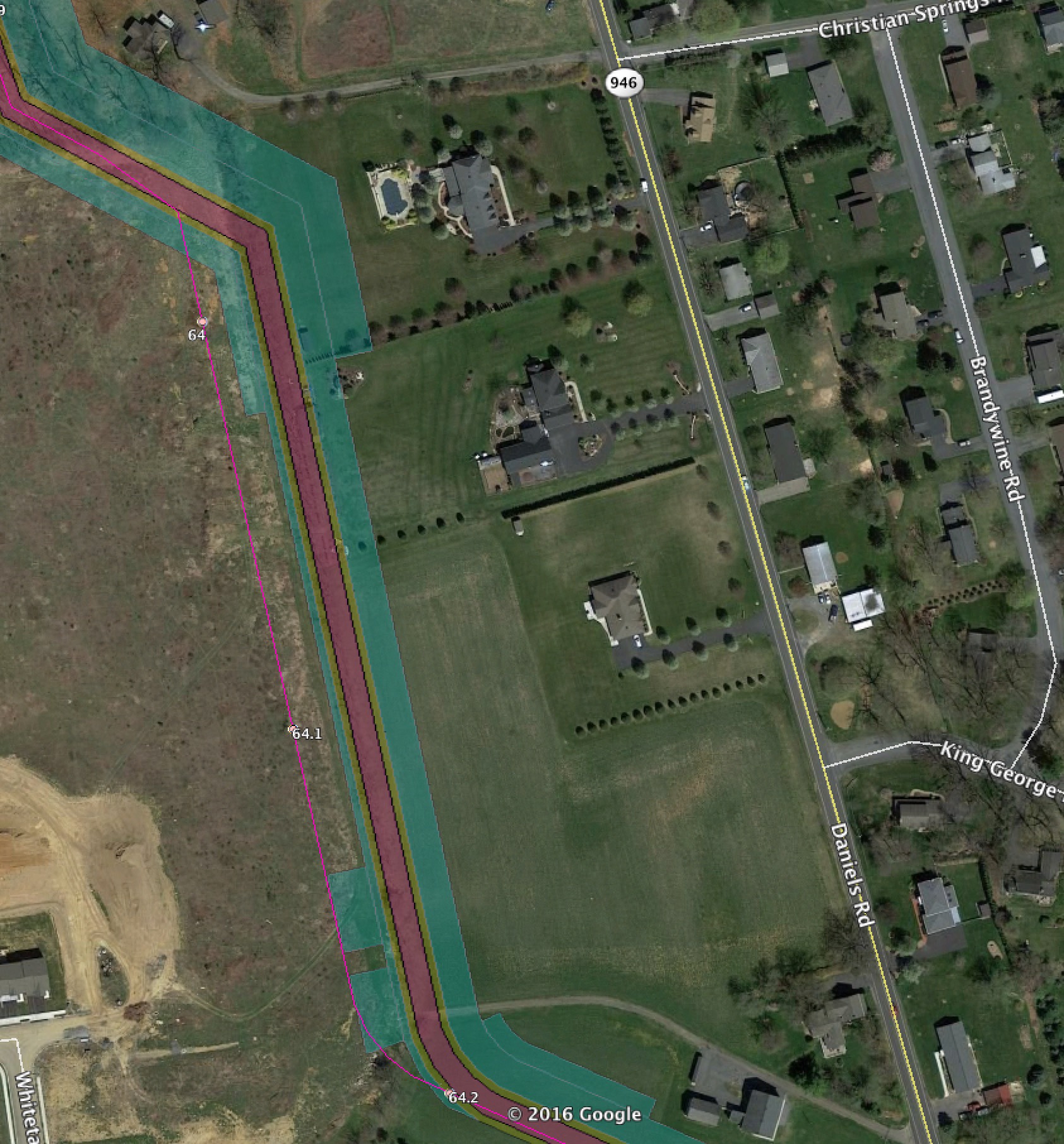
PA Daniels Road

Route moved closer to houses

changepadanielsroad

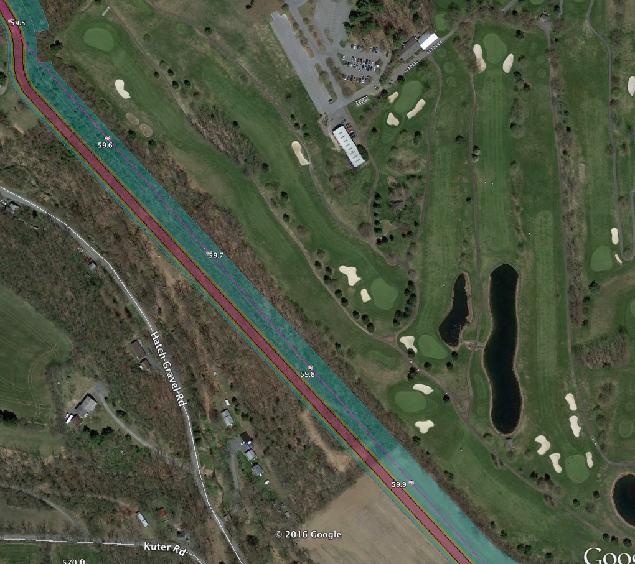
PA Move 50′ West of Golf course

changepakleinroadgolfcourse

PA Change across Dannersville Road

changepaedannersvilleroad

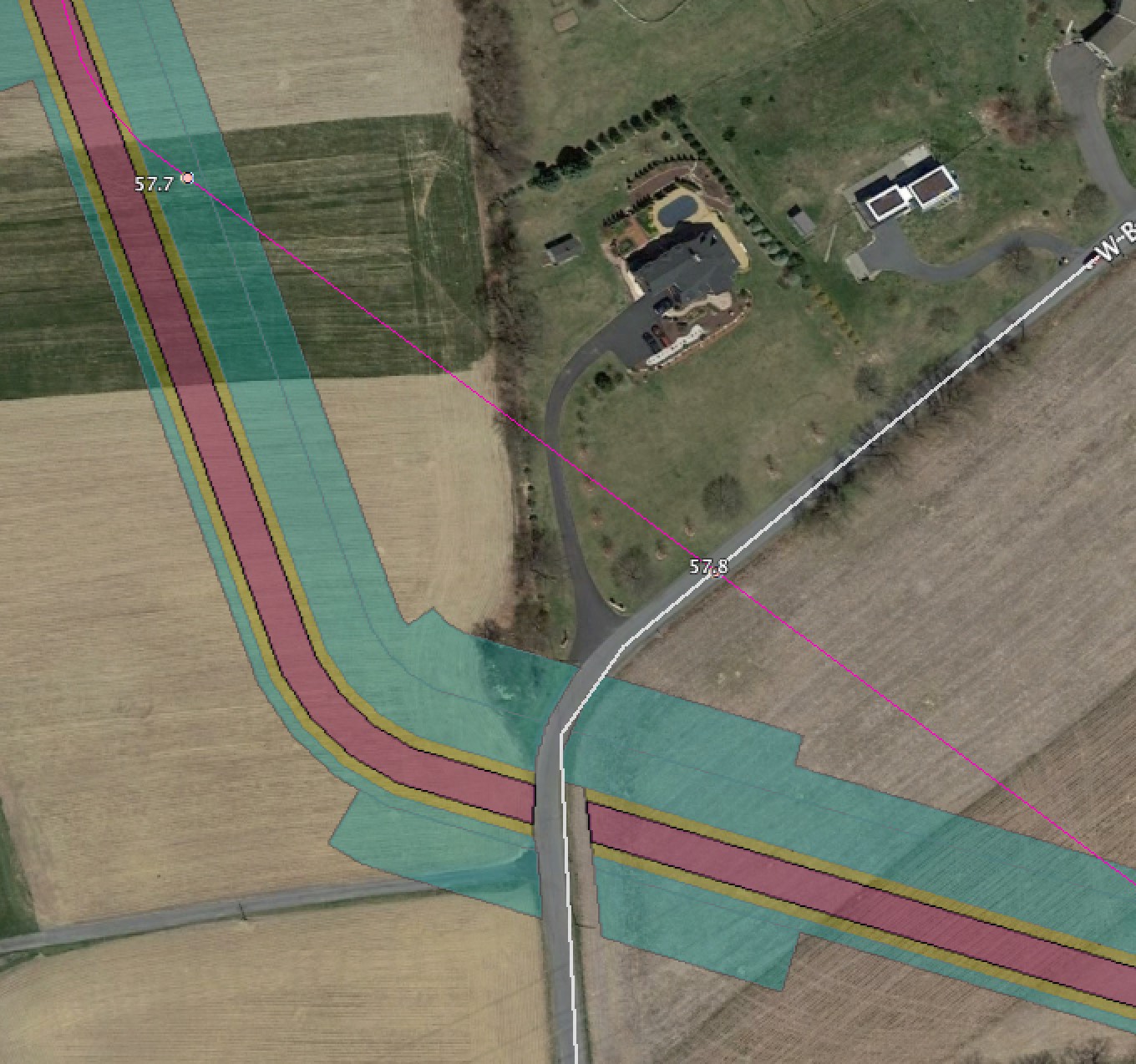
PA Change across West Beersville Road

changepaebeersvilleroad

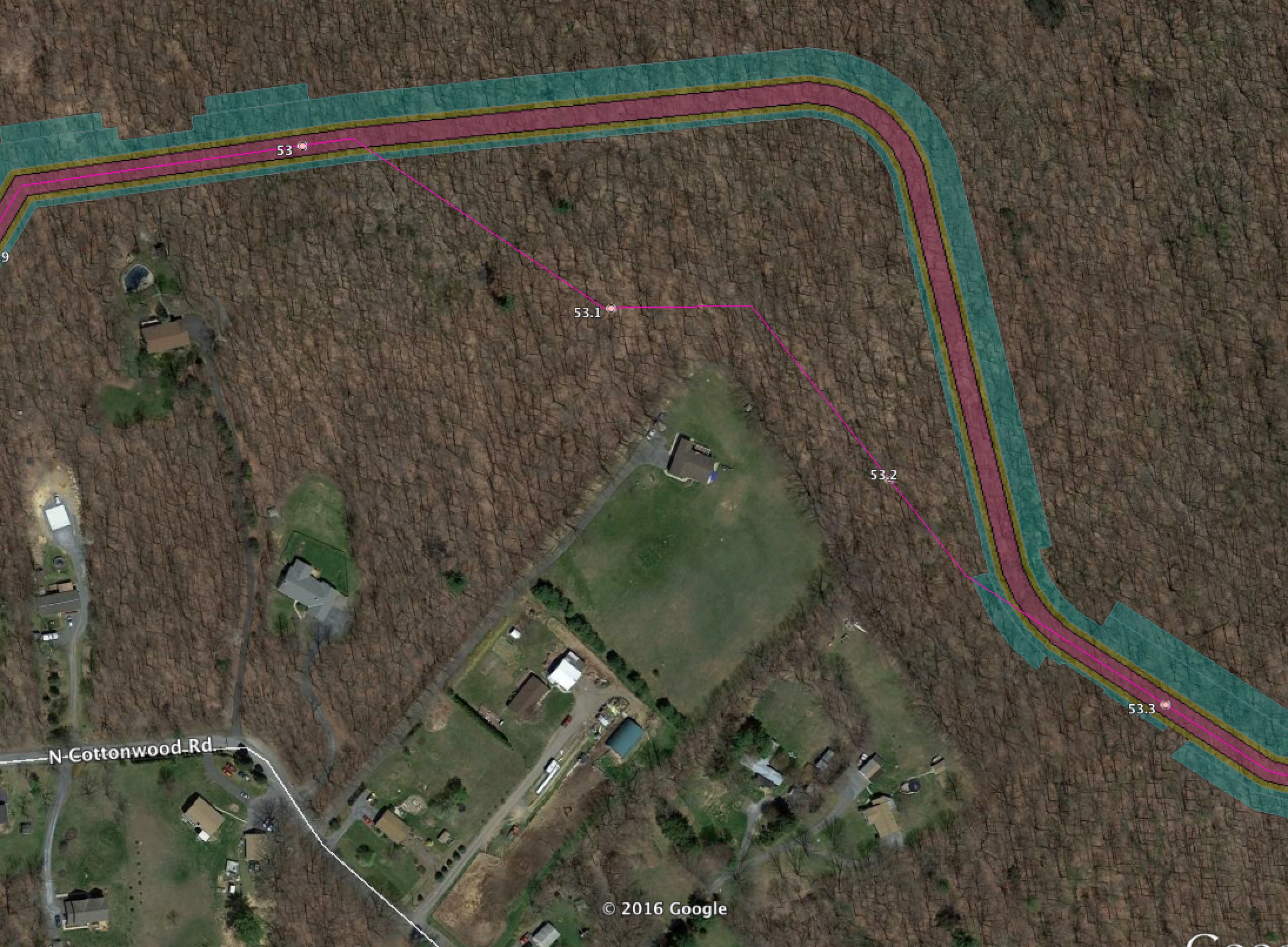
PA Change Cottonwood Road

Route expanded to cut more trees

changepanorthcottonwoodroad

PA Appalachian Trail HDD

A very large change by the Appalachian Trail.  They are now doing a very small HDD under the trail itself, but with the corresponding large HDD site impacts at entry/exit.  Plus far more extensive tree cutting to accommodate this route.

changepaappalachiantrail

PA Blue Mountain “Easy out” area

changepabluemountaineasyout

PA Blue Mountain Trail Area change

changepabluemountainslopes

PA Lower Smith Gap Road

A very large change moving the route over a thousand feet north on the other side of Lower Smith Gap Road.

changepalowersmithgaproad

PA Beltzville Lake HDD Impact

changepabeltzvillelakesouthhddsite

PA Lovitt Road extensive new construction areas for HDD support

changepalovittroad

PA Hatchery Road Major Change

A major change near Hatchery Road to try to bring the pipeline within a utility easement.  What it’s doing is actually widening an existing 200′ wide cut to 250′ wide.  And now, instead of going through a valley, it is going up and down the mountains on steep slopes.

changepahatcheryroad

PA Kidder Compressor Site

changeparoute80kiddercompressor

PA Route 2020 Changes

changeparoute2020

PA Shantyroad Road Quarry major changes

changepashantytownroadquarry

PA Auburn and Leidy Interconnects

Change for the interconnects into the UGI Auburn gathering system and the Transco Leidy line. The Leidy line is the one PennEast says doesn’t exist!

changepaauburnleidyinterconnects


Running these sites is getting expensive.  If you want to help out with the hosting and other costs of running thecostofthepipeline.com along with pipeinfo.org, then please take a look at the donate page.  Thanks!
Donate with PayPal